Hart Spring
1927
1999
Description:
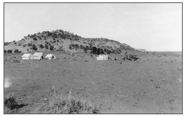
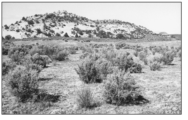
HART SPRING This photopoint is just 50 to 75 feet east of the west section line separating section 6 from section 1 T.31S., R.22E. The scene is looking west across BLM land onto an unfenced private 40 acre parcel at Hart Spring. Goldman's 1927 photograph is of a U.S. Geological Survey camp at Hart Spring. Hart Spring Draw is just beyond the camp and is not visible in either photograph. Soils here are Mido loamy fine sand. They are very deep, well drained, on sand drifts. They are rapidly permeable and have a moderate water supplying capacity. Average annual precipitation from 10 to 12 inches. When comparing the two images, it is obvious that vegetation has recovered considerable health and vigor since 1927. Plant frequencies and densities have resulted in a much more protective ground cover. Species here include sagebrush, rabbitbrush, Indian ricegrass, needle and thread grass, blue grama, cheatgrass and sixweeks fescue. When the 1999 photograph was taken, the land owner was in the process of fencing the 40 acre parcel from BLM land. Some camp debris can still be found on the site.
Photo Information:
Photograph Number: Goldman No. 366 Original: Date: May 16, 1927 (- A) Photographer: M.I. Goldman Source: U.S. Geological Survey, Denver, Colorado Retake: Date: May 11, 1999 (- B) Photographer: Earl Hindley Source: San Juan County
Vegetative Community:
Riparian
Location:
San Juan: SW1/4SW1/4 Section 6. T.31S., R.23E.