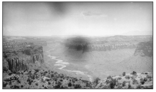
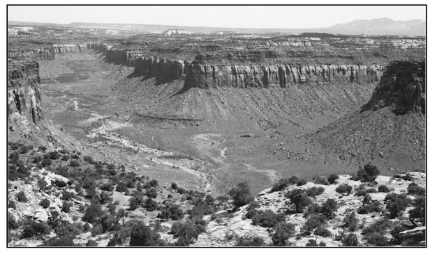
Hart Draw
1927
1999
Description:
HART DRAW The view is upstream of Hart Draw from an overlook described in the legal description. The entire area is public land administered by the Bureau of Land Management. Baker's original photograph is in relatively poor condition but still illustrates changes since 1927. immediately adjacent to the drainage channel are Torrifluvents that can be sodic. These soils are usually deep unstabilized sandy and gravelly soils that are frequently reworked by stream flow. Thus, vegetation has difficulty establishing below high water levels. Soils extending from the immediate floodplain and associated terraces to canyon walls consists of Nepalto gravelly sandy loam. These soils are deep with an effective rooting depth of more than 60 inches. The average annual precipitation in Hart Draw at this location ranges from 7 to 9 inches. The channel in Hart Draw has obviously narrowed with more vegetation established on the banks, floodplains and terraces. This is in spite of a very harsh situation where high flow events are common. The intermittent stream will not allow a major riparian habitat to establish here, but significant improvements have still been made.
Photo Information:
Photograph Number: Baker No. 280 Original: Date: 1927 (- A) Photographer: A.A. Baker Source: U.S. Geological Survey, Denver, Colorado Retake: Date: May 12, 1999 (- B) Photographer: Earl Hindley Source: San Juan County
Vegetative Community:
Riparian
Location:
San Juan: NW1/4SW1/4 Section 31 T.29 1/2 S. R., 22E.