Harris Flat
1936
2005
Description:
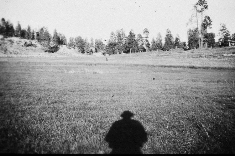
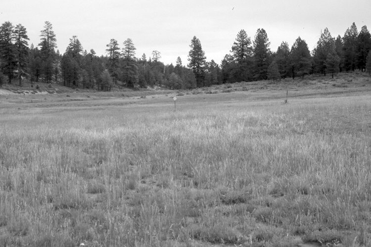
Plate 982X. Harris Flat 1936 – 2005 Viewed east to the old Harris Flat snow survey. The photopoint is approximately 150 yards east of the former ranger station on Harris Flat - - see Plate 566x. In 1936, a series of snow courses were established throughout southern Utah by what is today the Natural Resources Conservation Service (NRCS). When they were first set-up, photographs were taken at each snow survey site. Although the snow course at Harris Flat is no longer used by NRCS, the old photos remain. The steel post with the diamond marker seen in the retake is the starting point for the old snow course - - a person is standing at the same location in the 1936 image. Utah Highway 14 on the left has been widened and paved. Ponderosa pine has increased. The foreground is mostly Kentucky bluegrass, crested wheatgrass, and needle and thread. Snakeweed is also present. The shrubs on the hill in the center and on the right are currants, while the shrubs on the hill above the highway are bitterbrush.
Photo Information:
Original photograph (NRCS – 203) taken on September 8, 1936; retake by Charles E. Kay on July 31, 2005 - - Photo No. 5495-29. Original photograph held by the Snow Survey Supervisor, Natural Resources Conservation Service, Salt Lake City, UT.
Vegetative Community:
Conifer, Dry Meadow, Mountain Brush
Location:
South West: Section 19, Range 6 West, Township 38 South; UTM 369500 E, 4150250 N; elevation 7,800 ft.