Gooseberry Aspen Experiment
1968
2000
Description:
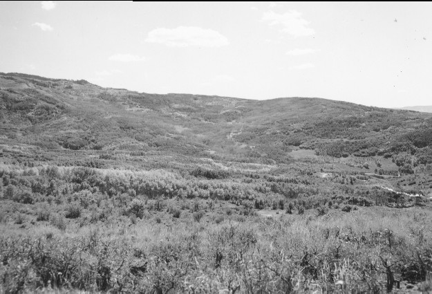
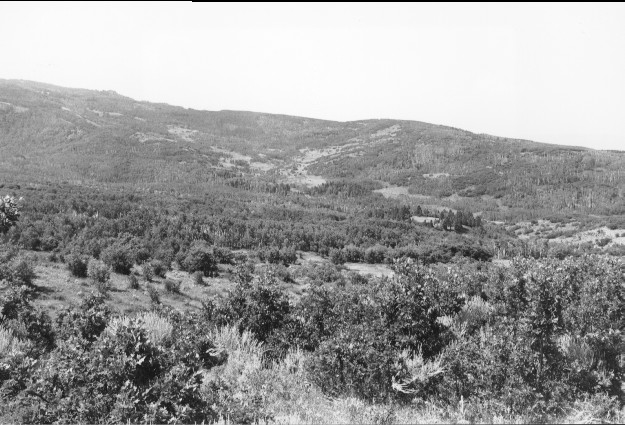
Plate 221. GOOSEBERRY ASPEN EXPERIMENT 1968-2000 Viewed southwest down Squaw Hollow to Sheep Creek behind the Gooseberry Ranger Station. During the early 1960’s, the Sheep Creek watershed was treated to remove aspen in an attempt to increase water yields. But as repeated herbicide applications killed the aspen, soil failures became common and the experiment was terminated. The new open areas along Sheep Creek in the retake are where aspen was killed. Oakbrush has increased in the foreground, while sagebrush has declined. The ponderosa pines on the hill, photo right center, were planted by the Forest Service. Utah serviceberry is present along Squaw Hollow, but is heavily browsed.
Photo Information:
U.S. Forest Service photo (unnumbered) taken by Donald E. Cox in September 1968; retake by Charles E. Kay on July 31, 2000 - - Photo No. 4651-22; Original photo (2530-26/1376 RO-TM) held by the Forest Service Regional Office Photographic Collection housed at Weber State University, Ogden, UT.
Vegetative Community:
Aspen, Oakbrush, Sagebrush, Conifer, Mountain Brush
Location:
South Central: Section 15, Range 2 E, Township 23 S; UTM 441500 E, 4295750 N; elevation 8,400 ft.