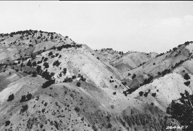
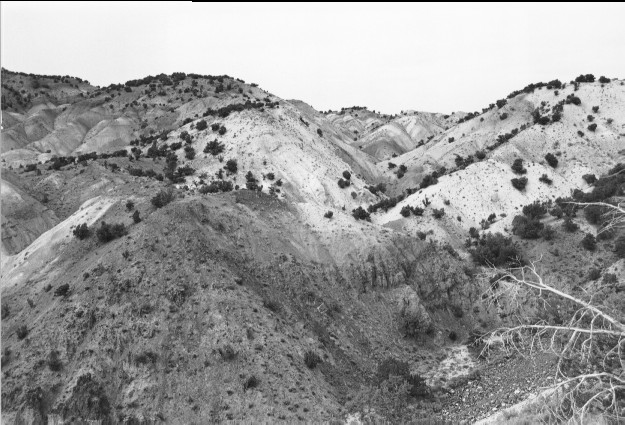
Glenwood Badlands
1931
2000
Description:
Plate 226. GLENWOOD BADLANDS 1931-2000 Viewed northeast from Utah Highway 119. The juniper in the lower right corner has recently died but otherwise there has been little apparent change on this harsh, naturally unvegetated site.
Photo Information:
U.S. Forest Service photo 264927 taken by Reed W. Bailey in 1931; retake by Charles E. Kay on July 31, 2000 - - Photo No. 4653-9; Original photo held by Utah Historical Society, Reed W. Bailey Collection, Salt Lake City, UT.
Vegetative Community:
Juniper
Location:
South Central: Section 30, Range 1 W, Township 24 S; UTM 418100 E, 4292300 N; elevation 6,100 ft.
January 2018