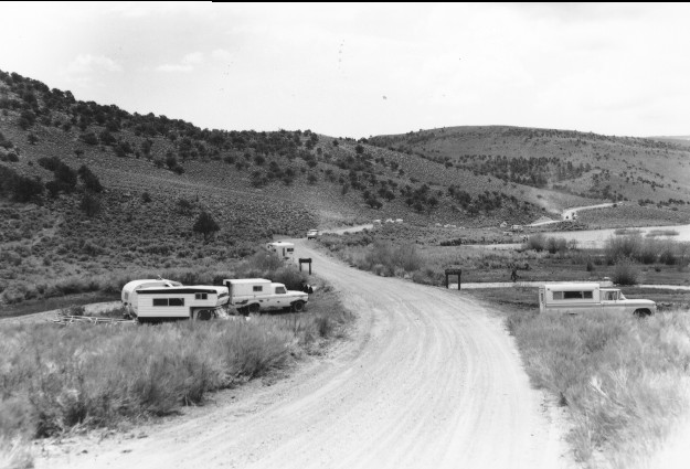
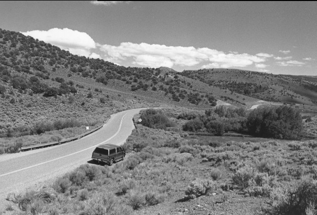
Fremont River
1962
1999
Description:
Plate 76. FREMONT RIVER: 1962 - 1999 This looks towards where the Fremont River enters Mill Meadow Reservoir. The 1962 camera station was destroyed by Utah highway 25 realignment and paving, thus the 1999 photo shows a slightly different perspective. Woody riparian vegetation along the river and pinyon (Pinus edulis) and juniper (Juniperus sp.) on the distant hillsides are more abundant in the 1999 photo than in 1962. Road reconstruction eliminated random camping in 1999, but livestock grazing continued.
Photo Information:
1962 photo taken by the U.S. Forest Service; 1999 photo is Kay #4465-29A, taken on Aug. 11. Forest Service photo held by the Loa Ranger District, Loa, UT
Vegetative Community:
Sagebrush, Pinyon, Juniper, Riparian
Location:
South Central: Mill Meadow Reservoir, Fishlake National Forest, Loa Ranger District, T26S, R3E, Sect. 27, UTM 4263250 N, 450400 E; elevation 7,720 ft., viewed to east.