Fivemile Ridge
1957
2005
Description:
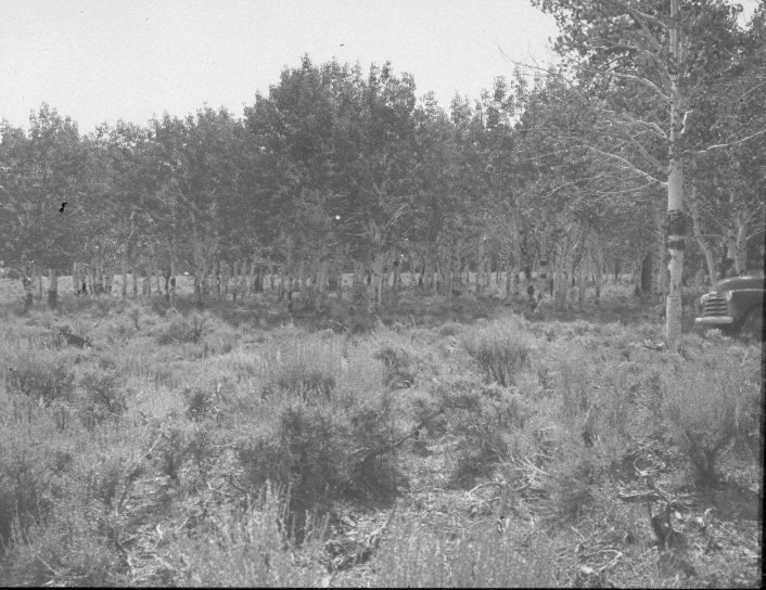
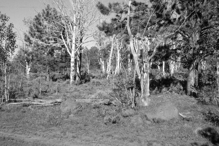
Plate 938X. Fivemile Ridge 1957 – 2005 The Parker Three-Step Transect on Fivemile Ridge is marked by a steel fence post on the west side of the road. Line one of the transect begins on the far side of the road and runs in a northeasterly direction, while the second line begins on the far side of the road but runs in a southeasterly direction; i.e. the two lines form a “V”. Plate 938x is viewed northeast from the steel fence post on the west side of the road - - this view in down the first transect line. Aspen has declined, while ponderosa pine has increased. Aspen has tried to regenerate but has failed to do so due to intense ungulate herbivory, primarily by cattle and elk, as the transect is near a stock pond. All aspen suckers and saplings have been heavily and repeatedly browsed. Mountain big sage has increased.
Photo Information:
U.S. Forest Service photograph (unnumbered) taken on September 5, 1957; retake by Charles E. Kay on June 26, 2005 - - Photo No. 5480-14. Original photographs, negatives, and reports held in the range files on the Cedar City Ranger District, Dixie National Forest, Cedar City, UT.
Vegetative Community:
Aspen, Conifer, Sagebrush
Location:
South West: Section 29, Range 6 West, Township 34 South; UTM 362900 E, 4187400 N; elevation 8,880 ft.