Escalante River
1872
2006
Description:
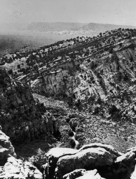
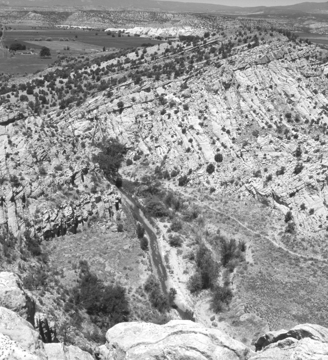
Plate 1236X. Escalante River 1872 – 2006 Viewed northwest up the Escalante River at the mouth of Escalante Canyon. The original photograph was taken before the Escalante Valley was settled - - note the irrigated fields in the retake. In 1872, the Escalante River flowed in a narrow channel lined with a dense growth of willows and river birch. Since then the channel has widened and downcut 10 to 15 feet. Willows and river birch are still present. In addition, cottonwoods and non-native tamarisk have appeared. The trail seen in the retake is a hiking trail, as livestock have been excluded from this area for a number of years. Pinyon and juniper have increased.
Photo Information:
Original photograph taken by John Hillers (No. 742) in 1872; retake by Charles E. Kay on June 21, 2006 - - Photo No. 5654-10A. Original photograph held by the U.S. Geological Survey Photographic Library, Denver, CO.
Vegetative Community:
Riparian, Pinyon, Juniper
Location:
South West: Section 9, Range 3 East, Township 35 South; UTM 449500 E, 4181000 N; elevation 6,000 ft.