Escalante River
1933
2004
Description:
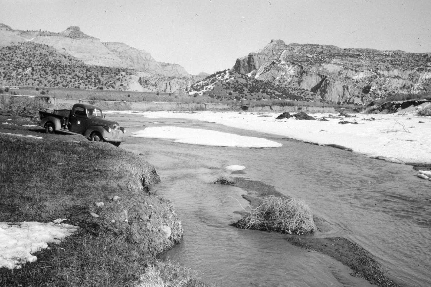
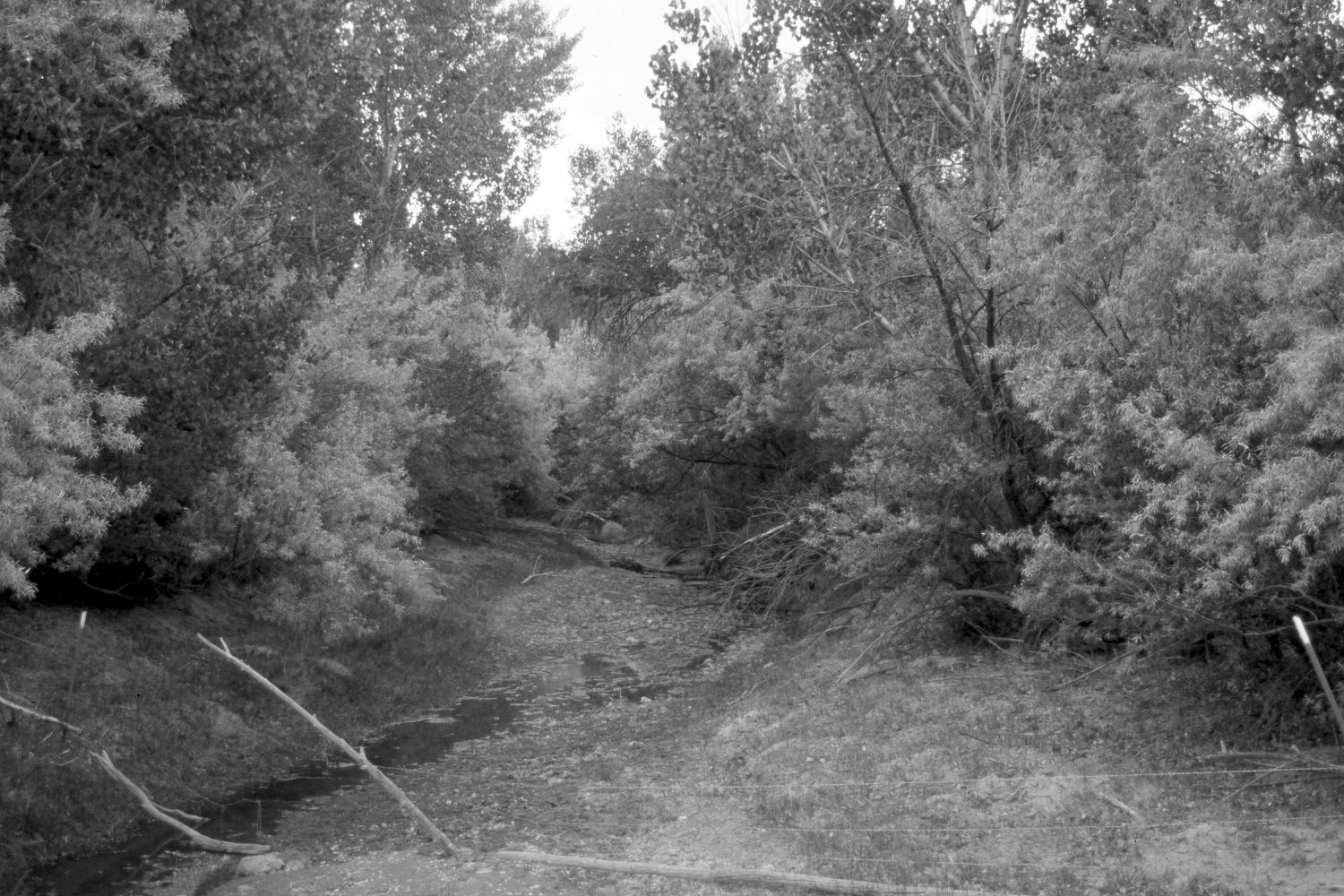
Plate 505X. Escalante River 1933 – 2004 Viewed east down the Escalante River to the upper end of Escalante Canyon. The photopoint is on the road to Hell’s Backbone. Needless to say, woody riparian vegetation has increased dramatically, despite continued livestock use on this private property. Cottonwoods, willows, and Russian olive are now abundant where they were absent in the past. Pinyon and juniper have increased in the distance.
Photo Information:
U.S. Forest Service photograph taken by an unknown photographer ca. 1933; retake by Charles E. Kay on June 10, 2004 - - Photo No. 5341-33. Original photograph held by Southern Utah University Archives and Special Collections, Cedar City, UT.
Vegetative Community:
Riparian, Pinyon, Juniper
Location:
South West: Section 8, Range 3 East, Township 35 South; UTM 447750 E, 4181050 N; elevation 5,720 ft.