Escalante River
1938
2002

Description:
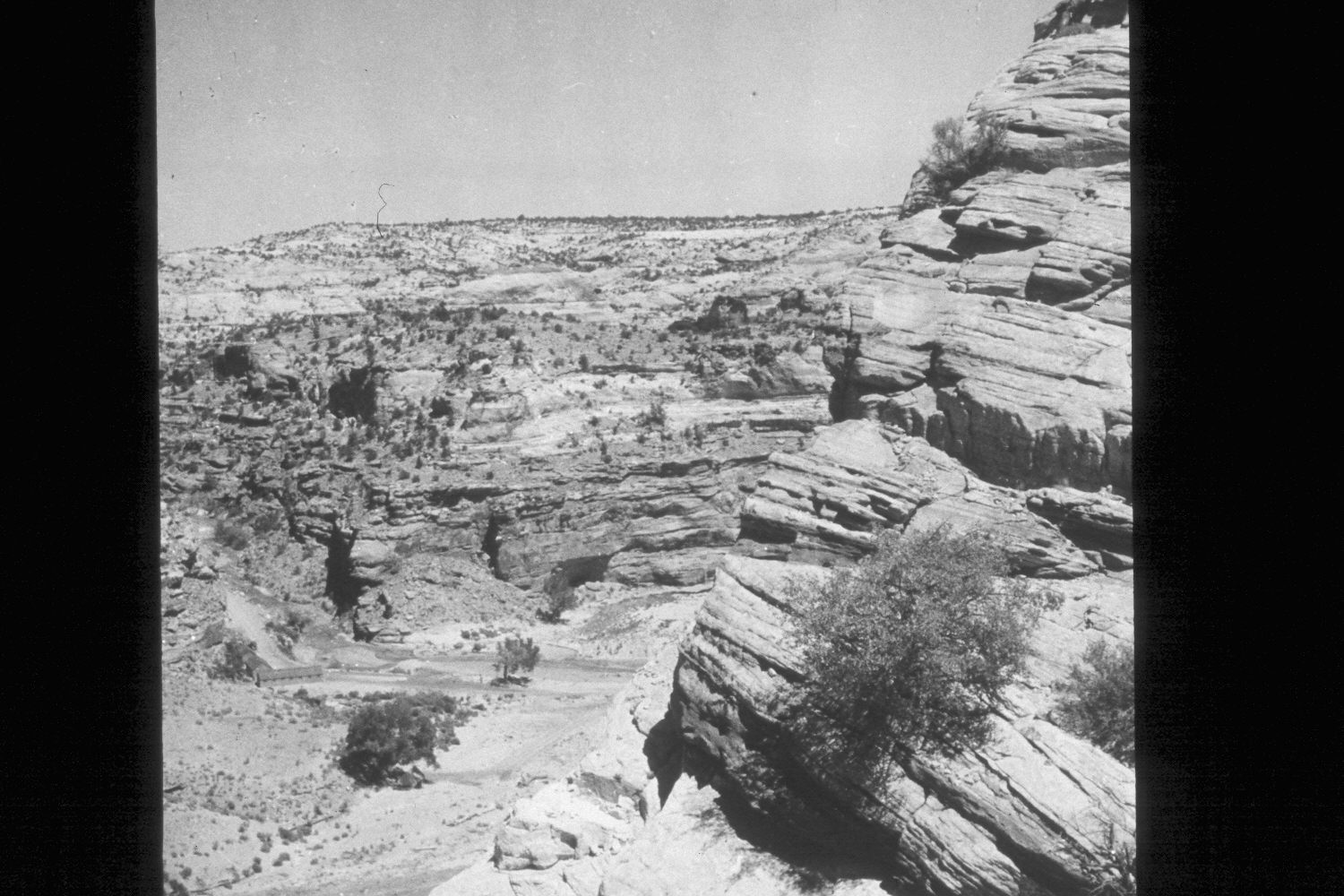
Plate 54X. Escalante River 1938-2002 Viewed east-northeast to the confluence of Calf Creek and the Escalante River from the overlook on Utah Highway 12. This is similar to Plate 53x. Note how little woody riparian vegetation there was in 1938 and how conditions have improved with proper range management. Most of the plants are willows and cottonwoods. Very little tamarisk is present. Pinyon and juniper appear to have increased ever so slightly.
Photo Information:
U.S. Forest Service photograph 369041 taken by W.H. Shaffer in August 1938; retake by Charles E. Kay on July 10, 2002 - - Photo No. 4973-15. Original photograph held by U.S. Forest Service Regional Photographic Collection (2310-Dixie-179) housed at Weber State University, Ogden, UT.
Vegetative Community:
Riparian, Pinyon, Juniper
Location:
South West: Section 12, Range 4 East, Township 35 South; UTM 462900E, 4180400N; elevation 5,550 ft.