Escalante River
1872
2006
Description:
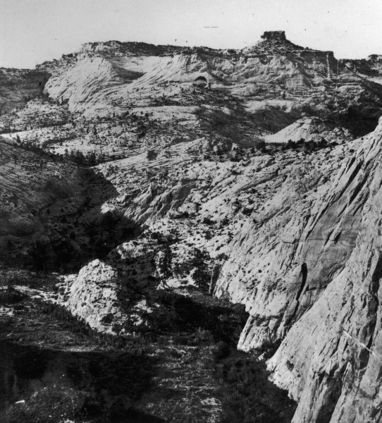
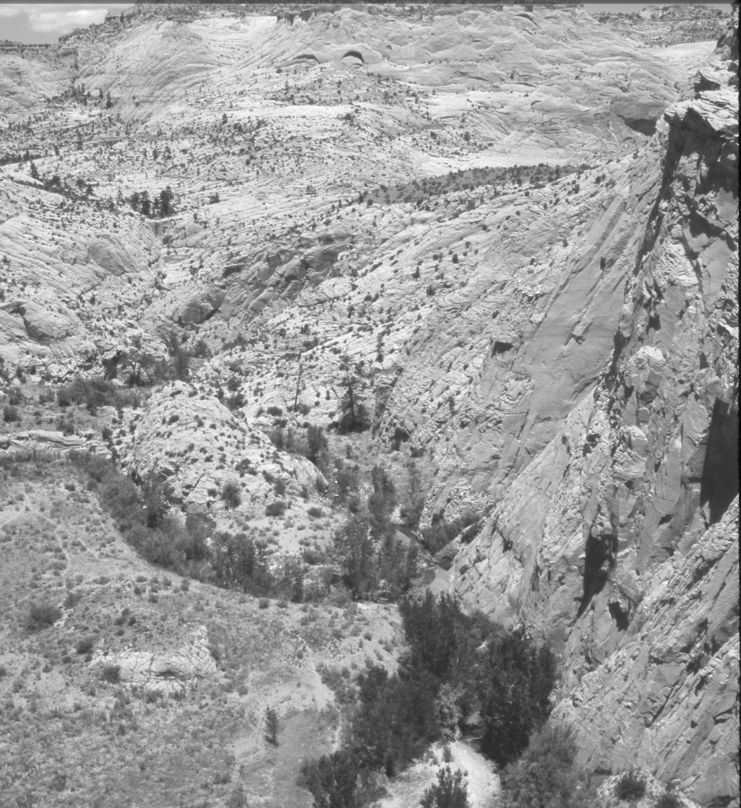
Plate 1237X. Escalante River 1872 – 2006 Viewed northeast to the confluence of Pine Creek and the Escalante River below the town of Escalante. The Escalante River flows from the bottom of the photo towards the top, while Pine Creek enters from the left. Both the Escalante River and Pine Creek were densely lined with willows and river birch in 1872. Today, both streams have widened and downcut 10 to 15 feet. Willows and river birch are still present, while the number of cottonwoods has increased since earlier times. Non-native tamarisk has also appeared. The number of ponderosa pine is about the same, but pinyon and juniper appear to have increased.
Photo Information:
Original photograph taken by John Hillers (No. 583) in 1872; retake by Charles E. Kay on June 21, 2006 - - Photo No. 5654-17A. Original photograph held by the U.S. Geological Survey Photographic Library, Denver, CO.
Vegetative Community:
Riparian, Pinyon, Juniper
Location:
South West: Section 9, Range 3 East, Township 35 South; UTM 449350 E, 4180900 N; elevation 5,880 ft.