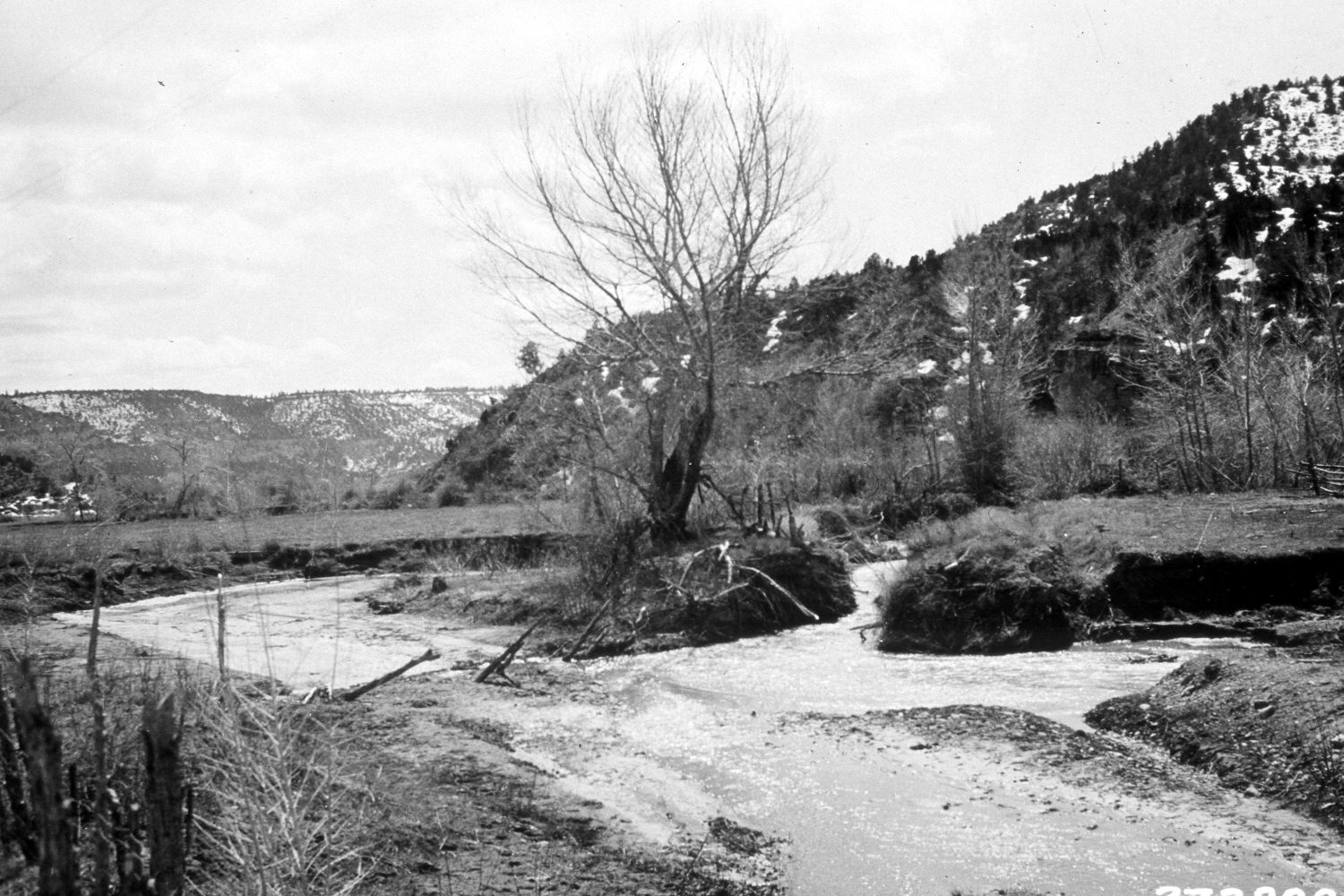
East Fork Of The Virgin River
1932
2004
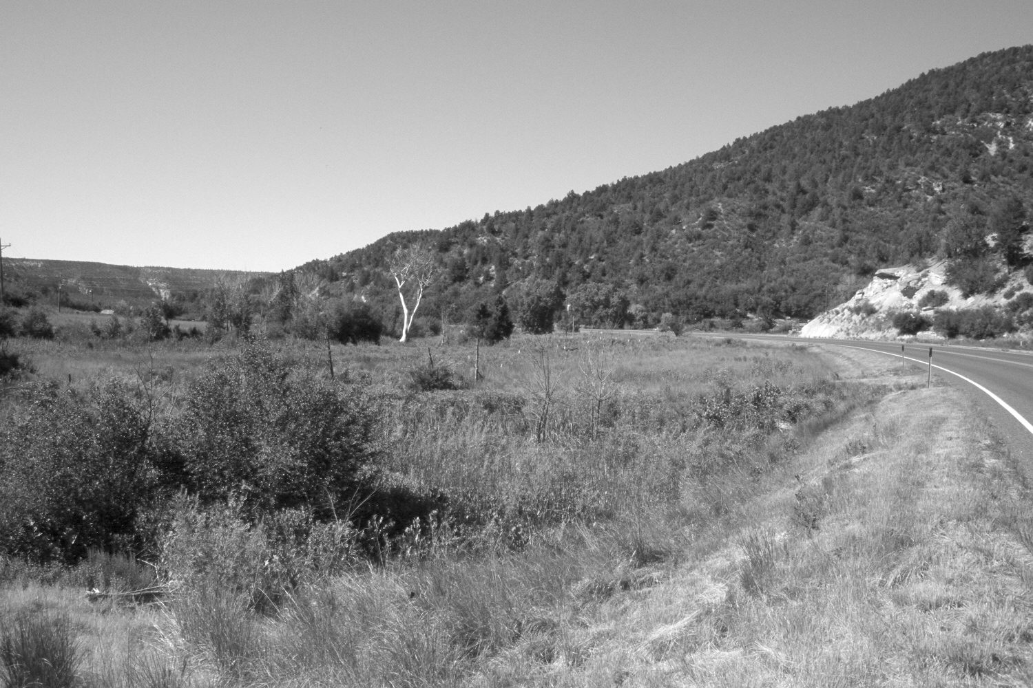
Description:
Plate 545X. East Fork of the Virgin River 1932 – 2004 Viewed south down the East Fork of the Virgin River about a mile and a half north of Glendale, UT. U.S. Highway 89 has been realigned, which has destroyed the original camera station. In addition, the river was moved into a new channel further to the left - - plus the stream is very heavily vegetated today, so the retake was made from the nearest open area. Thus, the perspective is slightly different in the retake. Nevertheless, the stream has narrowed and is more stable today than in 1932. The area in the foreground was swept by a small wildfire a few years before the 2004 image was made - - this top-killed the willows, cottonwoods, and box elder, which have since resprouted. However, the fire did temporarily reduce the volume of woody riparian visible in the retake. Pinyon and juniper have increased in the distance.
Photo Information:
U.S. Forest Service photograph (273899) taken by Reed Bailey in 1932; retake by Charles E. Kay on July 2, 2004 - - Photo No. 5360-11. Original photograph held by the Utah Historical Society, Reed W. Bailey Collection (Box 5), Salt Lake City, UT.
Vegetative Community:
Riparian, Pinyon, Juniper
Location:
South West: Section 11, Range 7 West, Township 40 South; UTM 358000 E, 4133850 N; elevation 5,950 ft.