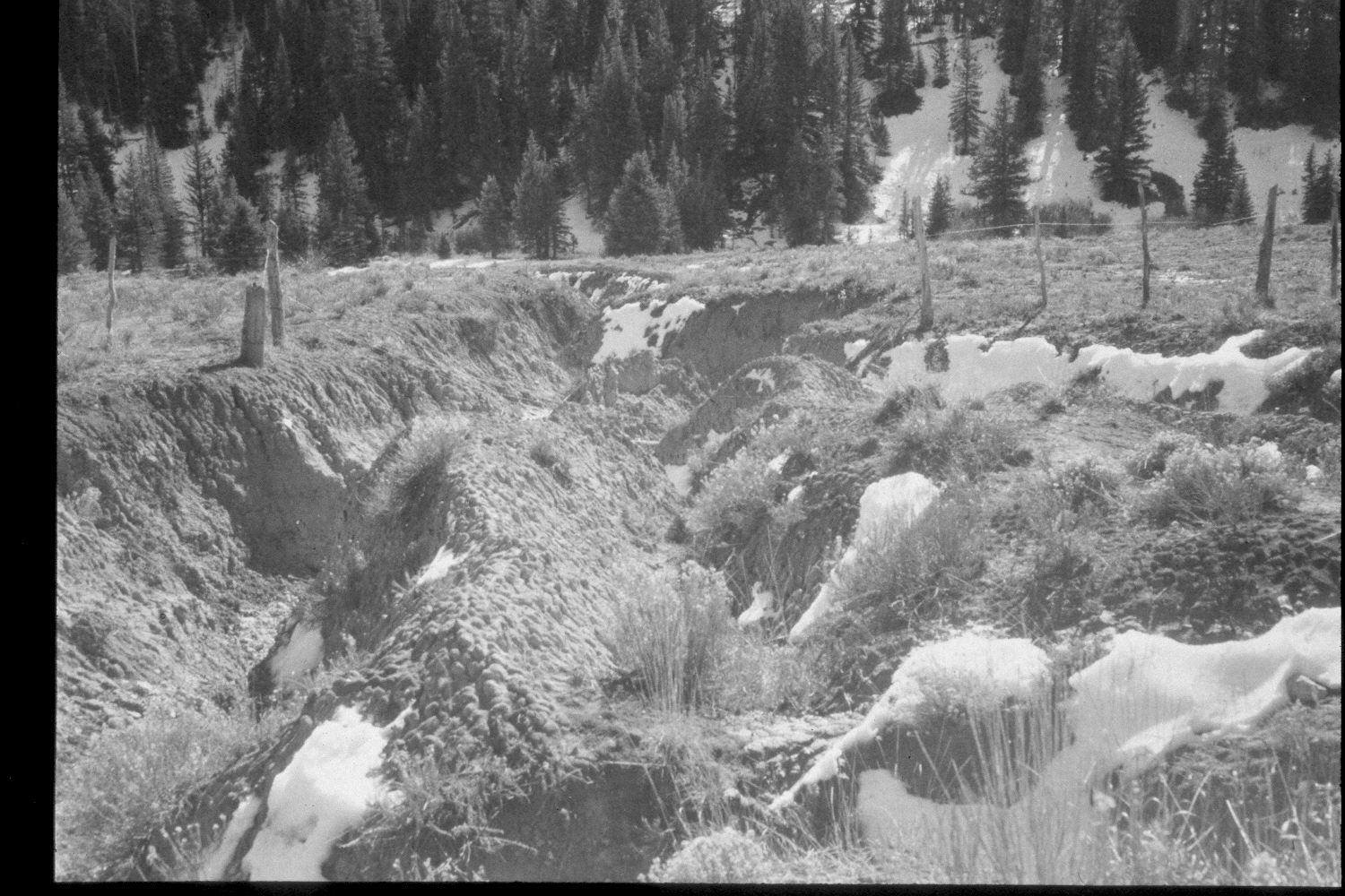
East Fork Of The Sevier River
1959
2003
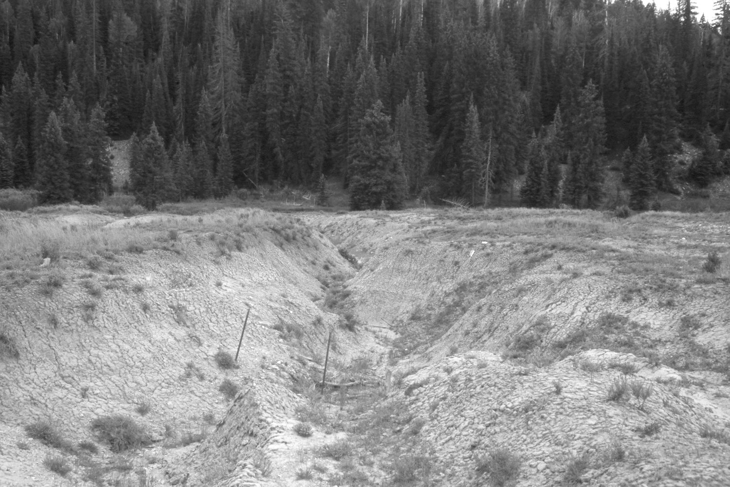
Description:
Plate 223X. East Fork of the Sevier River 1959 - 2003 Viewed south-southeast from the East Fork Road (USFS 087) approximately 300 yards below Sieler Creek. The East Fork of the Sevier River is at the toe of the slope. The fence has been eliminated and much of the surrounding area has been reseeded with non-native grasses to control erosion. This is the same gully as that in Plate 218x but viewed downhill. Spruce has increased. Retakes from this camera station were also made by the Forest Service in 1988 and 2003.
Photo Information:
U.S. Forest Service photograph (unnumbered) taken in the spring of 1959; retake by Charles E. Kay on August 3, 2003 - - Photo No. 5200-29. Original photograph held in the range files on the Panguitch Ranger District, Dixie National Forest, Panguitch, UT.
Vegetative Community:
Conifer, Dry Meadow
Location:
South West: Section 34, Range 4 ½ West, Township 38 South; UTM 382980E, 4146700N; elevation 8,260 ft.