East Fork Of The Sevier River
1959
2003
Description:
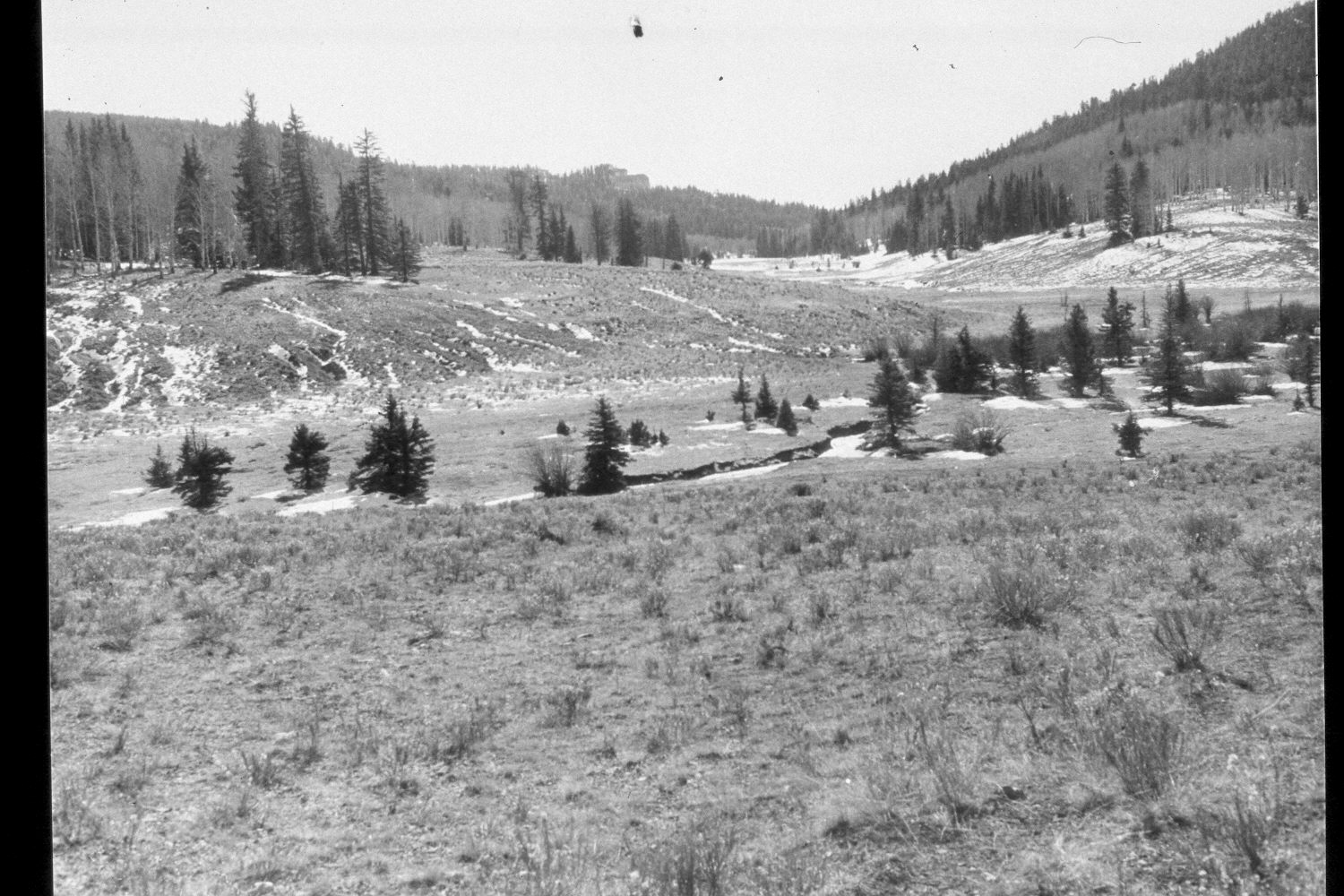
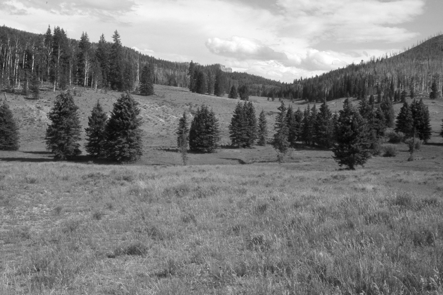
Plate 293X. East Fork of the Sevier River 1959 - 2003 Viewed south across the East Fork of the Sevier River and up Mill Creek on the Paunsaugunt Plateau. Willows are still present, but many plants are now hidden from view by encroaching spruce. Conifers, primarily spruce and white fir, have increased, while aspen has declined. A few aspen stems were able to escape browsing during the early 1970s when mule deer numbers were low (Kay and Bartos 2000), but those saplings have since been highlined and today, all aspen suckers are repeatedly browsed by wildlife and livestock. Willows are also heavily browsed. The low shrubs are mostly rubber rabbitbrush and shrubby cinquefoil. The hill on the upper-right edge of the photo was recently burned by wildfire. The streambanks appear more heavily vegetated today than they did in 1959. The area was actively being grazed by cattle in 2003.
Photo Information:
Additional retakes were made by the Forest Service in 1988 and 2000. U.S. Forest Service photograph (unnumbered) taken in 1959; retake by Charles E. Kay on August 7, 2003 - - Photo No. 5229-20. Original photograph held in the range files on the Panguitch Ranger District, Dixie National Forest, Panguitch, UT.
Vegetative Community:
Riparian, Conifer, Aspen
Location:
South West: Section 10, Range 4½ West, Township 38 South; UTM 381200E, 4144200 N; elevation 8,320 ft.