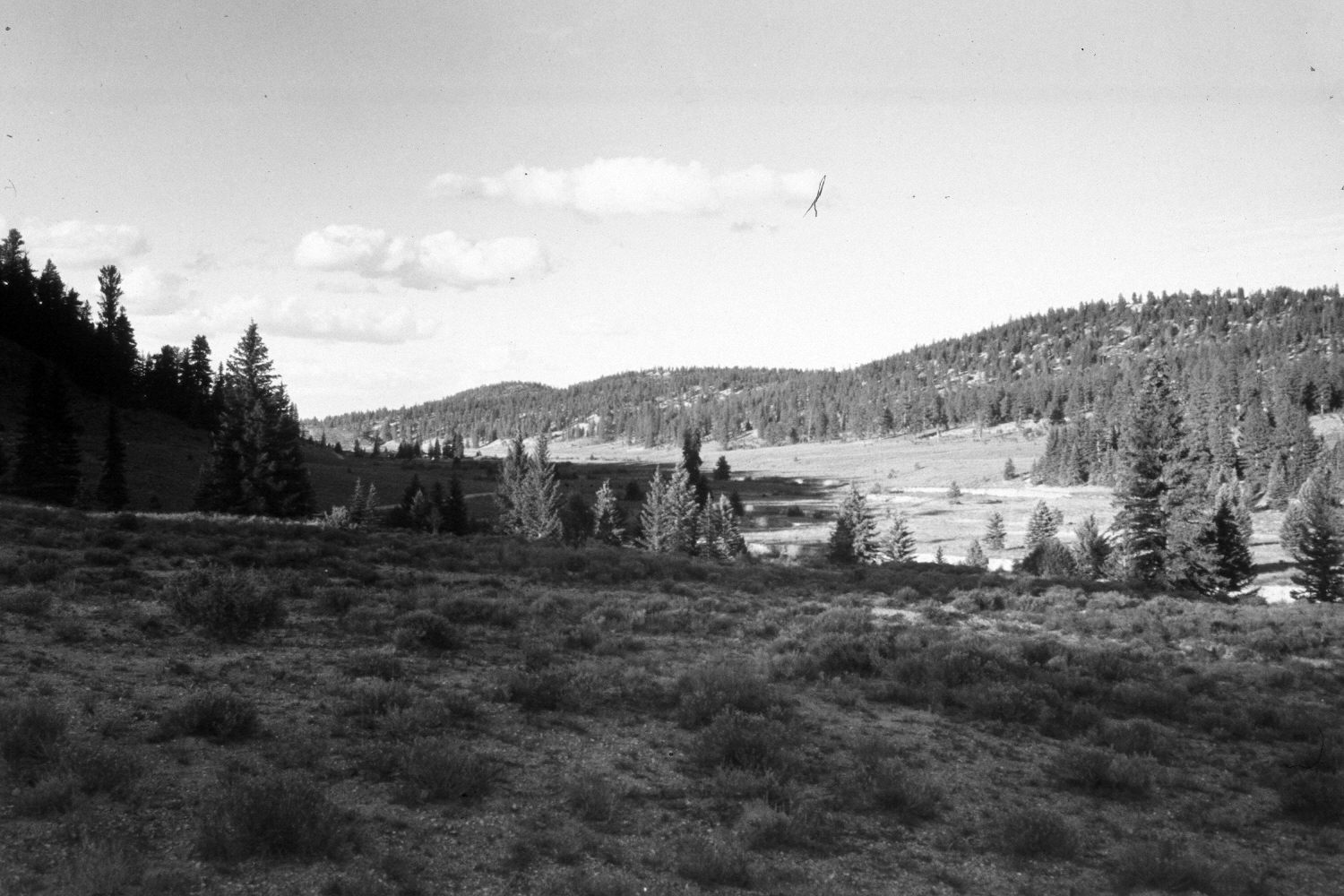
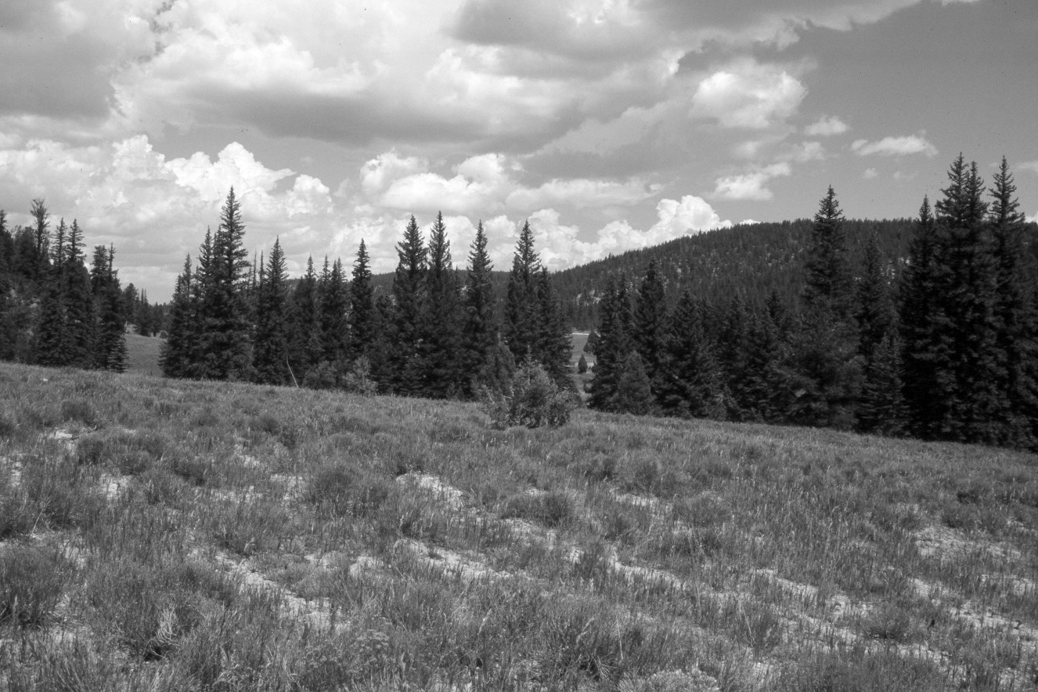
East Fork Of The Sevier River
1940
2003
Description:
Plate 299X. East Fork of the Sevier River 1940 - 2003 Viewed northeast down the East Fork of the Sevier River below Long Creek on the Paunsaugunt Plateau. The photopoint is just east of the old Westside Road, which has been abandoned and revegetated. The area in the foreground has been contour-trenched and reseeded with smooth brome by the Forest Service to control erosion. The shrubs are mostly rubber rabbitbrush with some mountain big sage. Despite repeated logging, spruce, ponderosa pine, and juniper have all increased.
Photo Information:
U.S. Geological Survey photograph by H.E. Gregory (No. 1053) taken in 1940; retake by Charles E. Kay on August 8, 2003 - - Photo No. 5231-11. Original photograph held by the U.S. Geological Survey Photographic Library, Denver, CO.
Vegetative Community:
Dry Meadow, Sagebrush, Conifer, Juniper
Location:
South West: Section 18, Range 4 West, Township 37 South; UTM 388700E, 4160100 N; elevation 7,880 ft.