East Fork Of The Sevier River
1961
2003
Description:
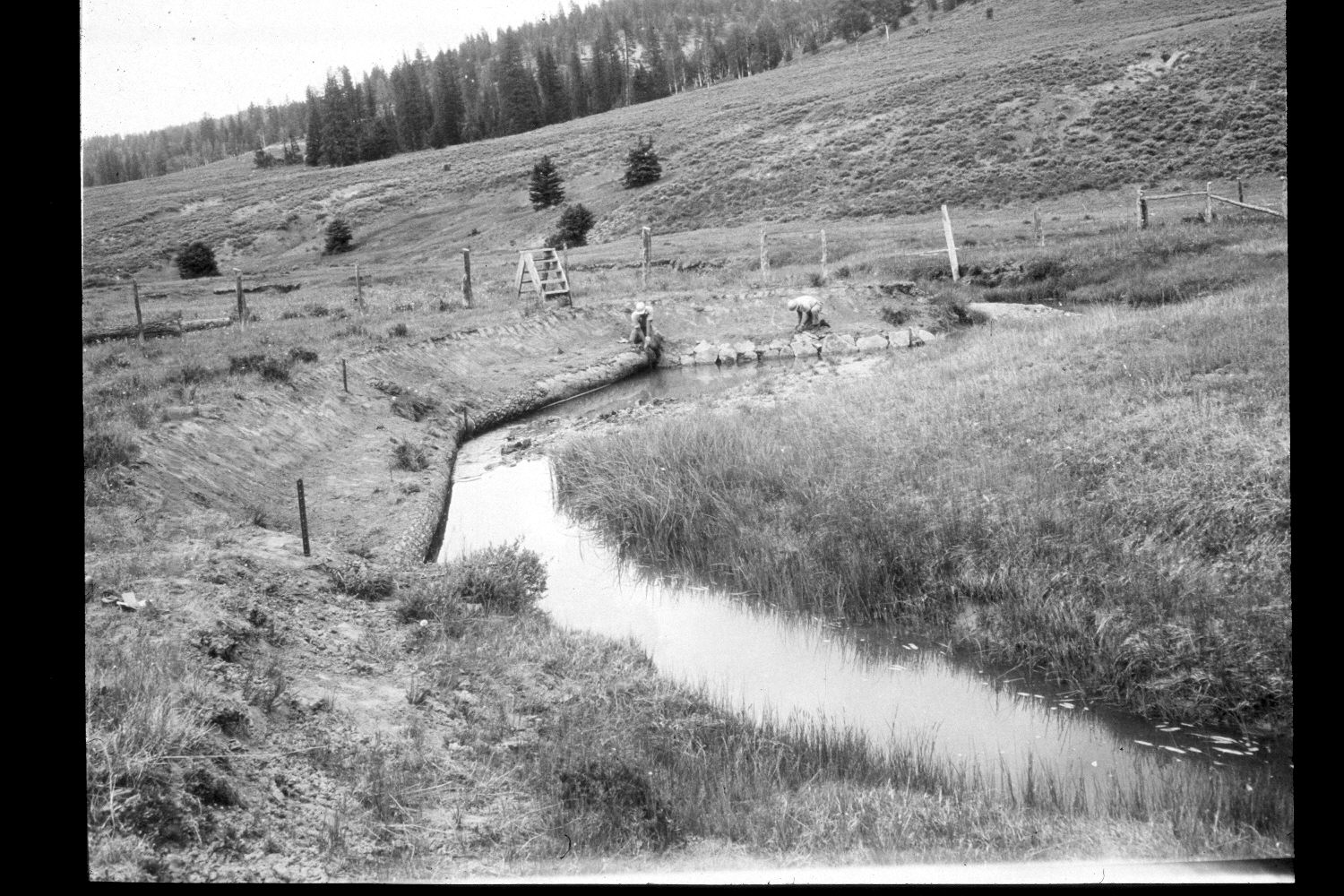
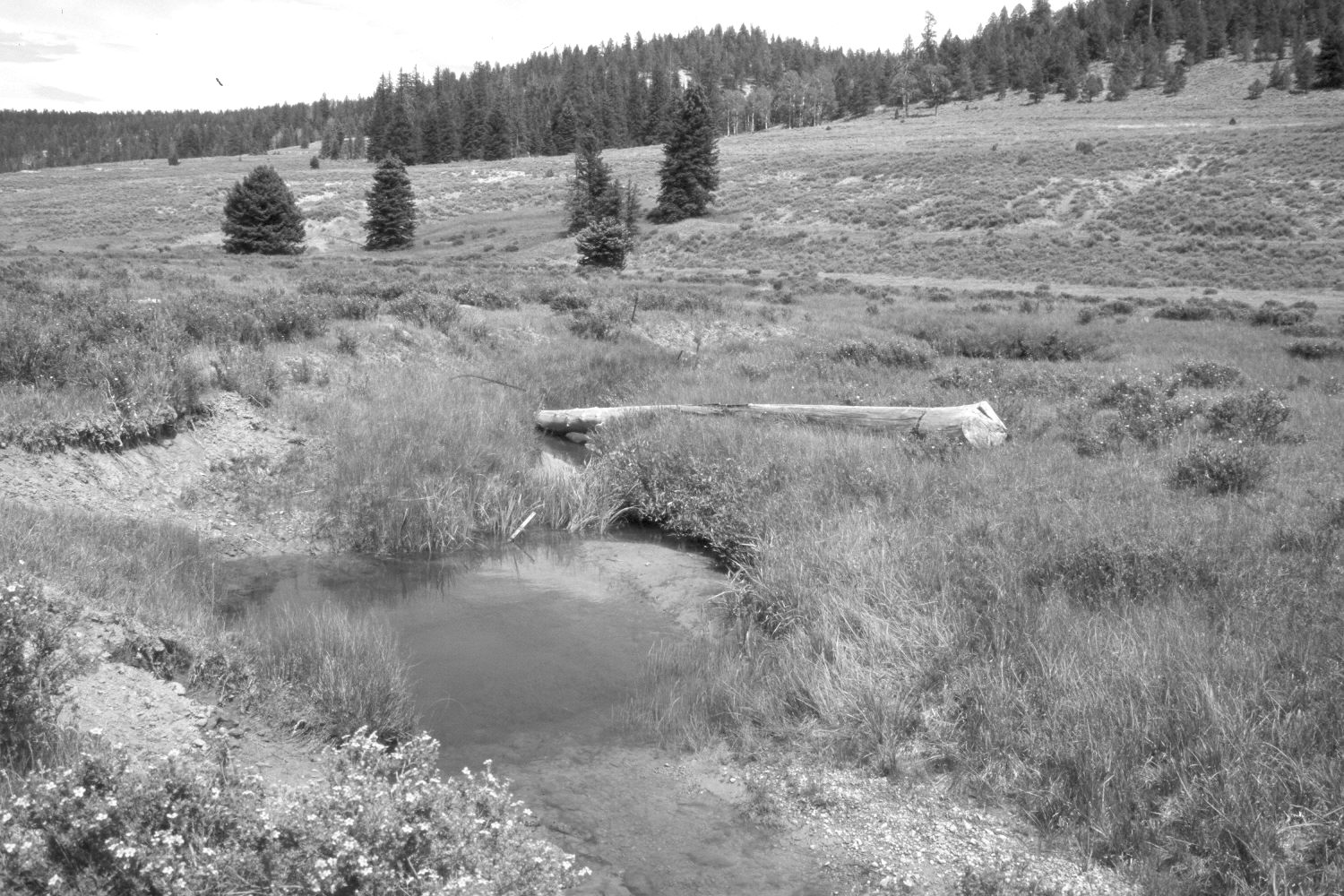
Plate 292X. East Fork of the Sevier River 1961 - 2003 Viewed northeast down the East Fork of the Sevier River between Kanab Creek and Puma Hollow on the Paunsaugunt Plateau. The original image shows bank stabilization structures constructed by the Forest Service inside a riparian exclosure. The fence has since been removed and the logs have either decomposed or been moved by high-water events. The stream channel has narrowed and deepened, and the banks are more heavily vegetated today than in the past. Shrubby cinquefoil has increased on the floodplain, but mountain big sage appears unchanged on the far hillside. Spruce and ponderosa pine have increased despite logging, while aspen has declined. The hillside above the stream has been contour-trenched and reseeded by the Forest Service to control erosion. The area had not been grazed by livestock in 2003 when the camera station was revisited.
Photo Information:
U.S. Forest Service photograph (unnumbered) taken by K. Keck on June 23, 1961; retake by Charles E. Kay on August 7, 2003 - - Photo No. 5227-29. Original photograph (2630-Habitat-Dixie) held by the Forest Service Regional Office Photographic Collection housed at Weber State University, Ogden, UT.
Vegetative Community:
Riparian, Sagebrush, Conifer, Aspen, Dry Meadow
Location:
South West: Section 1, Range 4½ West, Township 38 South; UTM 386000E, 4153850 N; elevation 7,960 ft.