East Fork Of The Sevier River
1963
2003
Description:
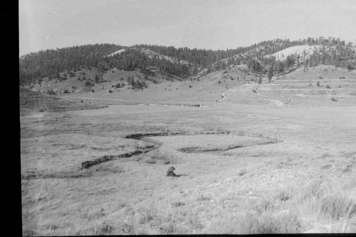
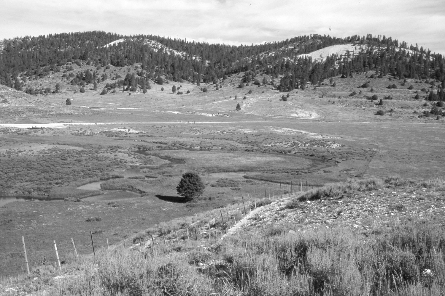
Plate 264X. East Fork of the Sevier River 1963-2003 Viewed northwest across the East Fork of the Sevier River just above its confluence with Blubber Creek on the Paunsaugunt Plateau. The low shrubs in the foreground are sagebrush, while those along the stream are shrubby cinquefoil. Juniper, spruce, and ponderosa pine have all increased. Many of the distant hillsides have been contour-trenched and reseeded by the Forest Service to control erosion. A new allotment fence has been built to more closely manage livestock. The lower section of Blubber Creek has been re-routed to control erosion - - note the three new culverts in the East Fork Road (photo left-center edge) where Blubber Creek now flows. Retakes were also made by the Forest Service in 1983 and 2000.
Photo Information:
U.S. Forest Service photograph (unnumbered) taken in 1963; retake by Charles E. Kay on August 6, 2003 - - Photo No. 5218-5A. Original photograph held in the range files on the Panguitch Ranger District, Dixie National Forest, Panguitch, UT.
Vegetative Community:
Sagebrush, Juniper, Conifer, Riparian
Location:
South West: Section 36, Range 4½ West, Township 37 South; UTM 387200E, 4156050 N; elevation 7,970 ft.