East Fork Of The Sevier River
1964
2003
Description:
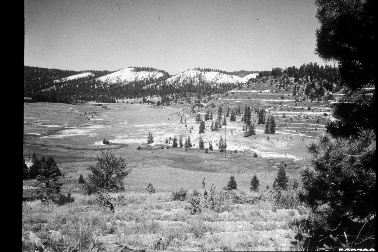
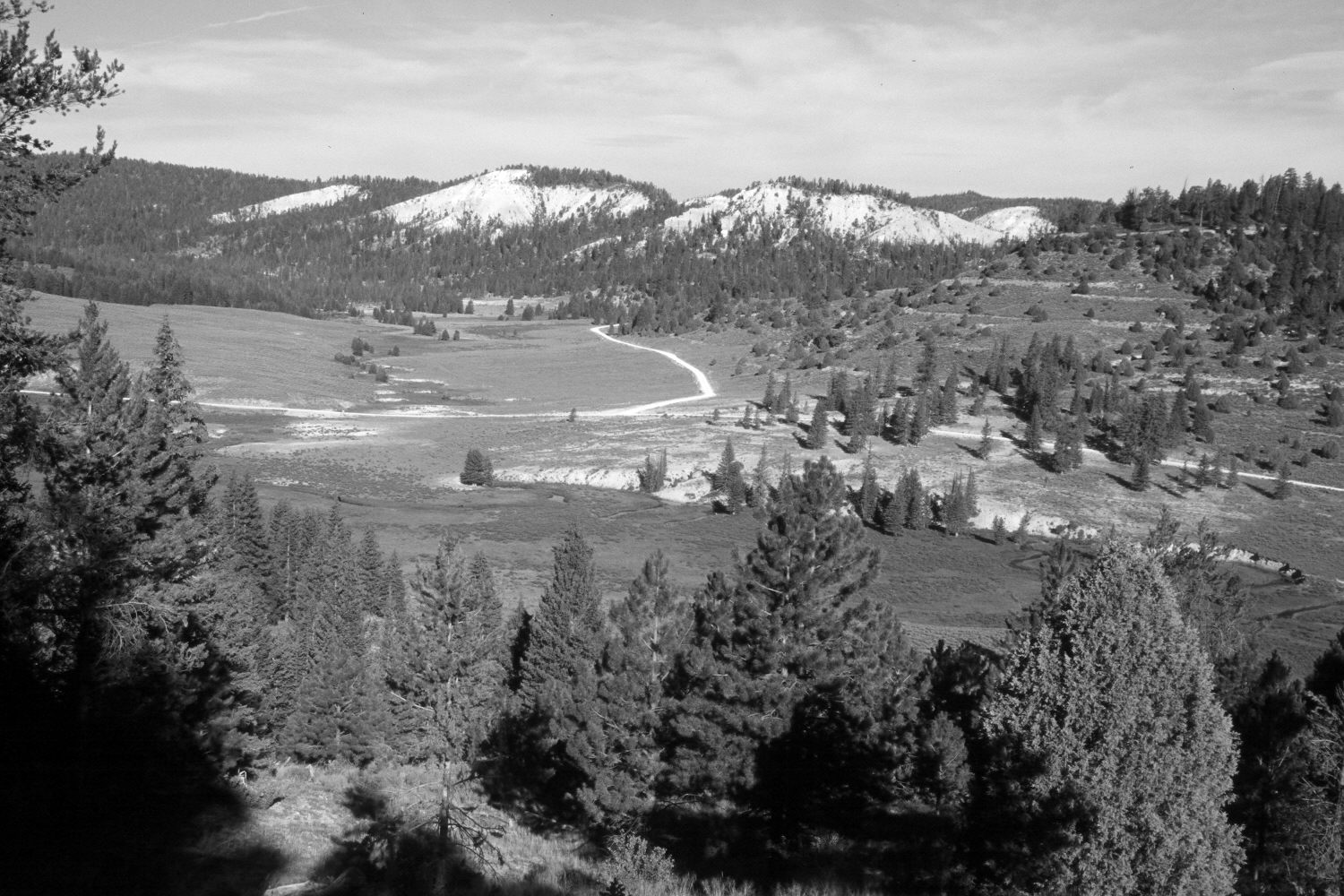
Plate 260X. East Fork of the Sevier River 1964-2003 Viewed west across the East Fork of the Sevier River and up Kanab Creek on the Paunsaugunt Plateau. Conifers now block the original view so the retake was made from the nearest open area, which is a little further to the south (left). The area in the foreground had been contour-trenched and reseeded with non-native grasses by the Forest Service to control erosion a year or two prior to when the original image was taken. Spruce, ponderosa pine, and juniper have all increased. Note the reseeding seen in Plates 248x and 256x, as well as the new road up Kanab Creek. The low-growing shrubs along the East Fork are mostly shrubby cinquefoil, while sagebrush is common on the drier hillsides.
Photo Information:
U.S. Forest Service photograph (508798) taken by Prater in August 1964; retake by Charles E. Kay on August 6, 2003 - - Photo No. 5216-20. Original photograph held by U.S. Forest Service Regional Office Photographic Collection housed at Weber State University, Ogden, UT.
Vegetative Community:
Dry Meadow, Conifer, Juniper, Sagebrush
Location:
South West: Section 1, Range 4½ West, Township 38 South; UTM 386250E, 4154900 N; elevation 8,120 ft.