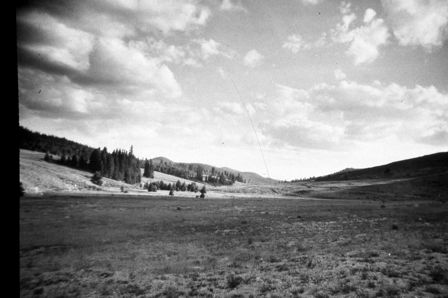
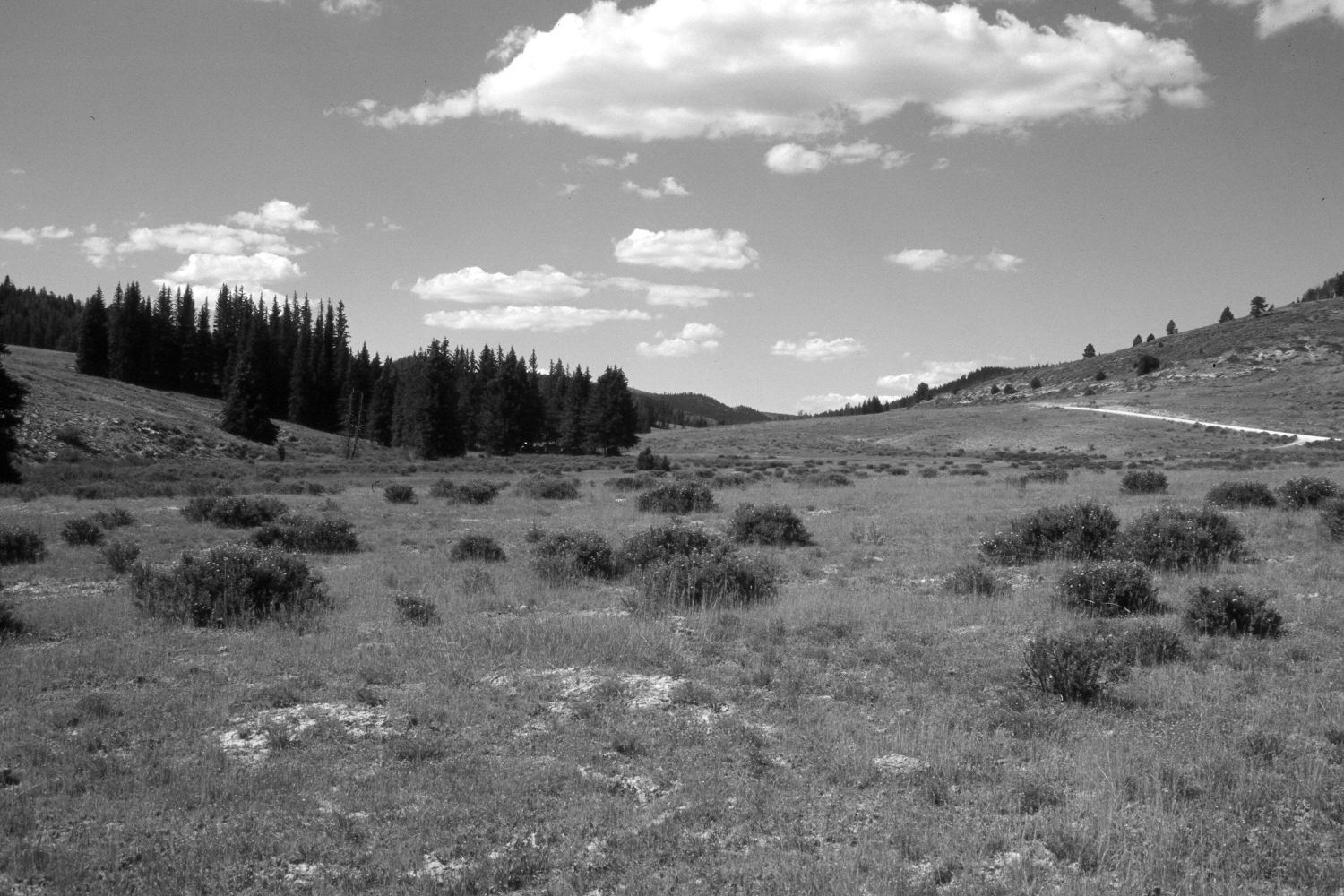
East Fork Of The Sevier River
1940
2003
Description:
Plate 233X. East Fork of the Sevier River 1940 - 2003 Viewed southwest up the East Fork of the Sevier River just above its confluence with Crawford Creek. The East Fork flows along the toe of the slope on the left. The shrubs in the retake are mostly shrubby cinquefoil. In the distance, spruce has increased, while aspen has declined. Much of the area has been reseeded with smooth brome, intermediate wheatgrass, and Kentucky bluegrass to control erosion. The East Fork Road (USFS 087) is on the right in both photos.
Photo Information:
U.S. Geological Survey photograph taken by H.E. Gregory (No. 980) in 1940; retake by Charles E. Kay on August 4, 2003 - - Photo No. 5206-18A. Original photograph held by U.S. Geological Survey Photographic Library, Denver, CO.
Vegetative Community:
Riparian, Conifer, Aspen, Dry Meadow
Location:
South West: Section 14, Range 4 ½ West, Township 38 South; UTM 385800E, 4150400N; elevation 8,080 ft.