East Fork Of The Sevier River
1943
2003
Description:
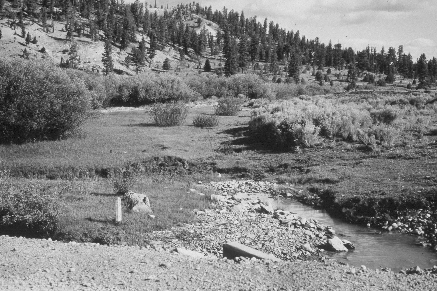
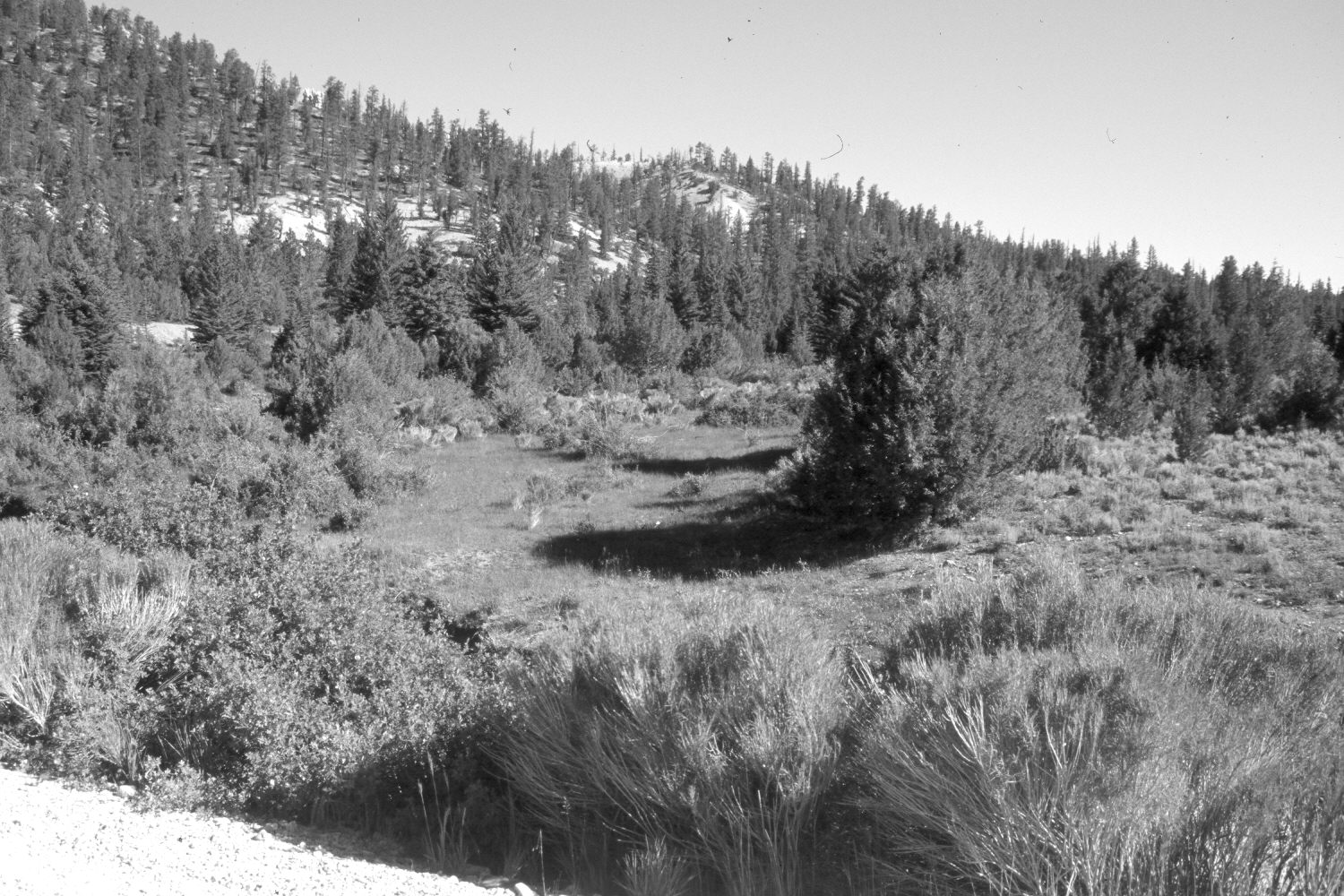
Plate 150X. East Fork of the Sevier River 1943-2003 Viewed northwest down the East Fork of the Sevier River immediately below Tropic Reservoir. Rubber rabbitbrush and woods rose (Rosa woodsii) have grown-up along the edge of the road and now block the stream from view. Nevertheless, the East Fork has downcut 6 to 8 feet, which has lowered the water table, and dried-out former riparian areas. This has allowed pinyon, juniper, and other conifers to invade the floodplain, while willows have declined. These hydrologic changes commonly occur below reservoirs because silt and other bedload material settle out behind the dam giving the water renewed energy. Thus, when clear water is released below a reservoir, it tends to erode the stream channel. This is what has happened below Tropic Reservoir. Rose, rubber rabbitbrush, and currant (Ribes spp.) too have invaded the floodplain, as the water table has fallen. Spruce, ponderosa pine, pinyon, and juniper have increased on the more distant hillsides. Conversely, sagebrush has declined where it has been over-topped by other woody species.
Photo Information:
U.S. Forest Service photograph (unnumbered) taken on August 22, 1943; retake by Charles E. Kay on June 25, 2003 - - Photo No. 5173-14. Original photograph held by Southern Utah University Archives and Special Collections, Cedar City, UT.
Vegetative Community:
Riparian, Pinyon, Juniper, Conifer, Sagebrush
Location:
South West: Section 5, Range 4 West, Township 37 South; UTM 389800 E, 4163400 N; elevation 7,830 ft.