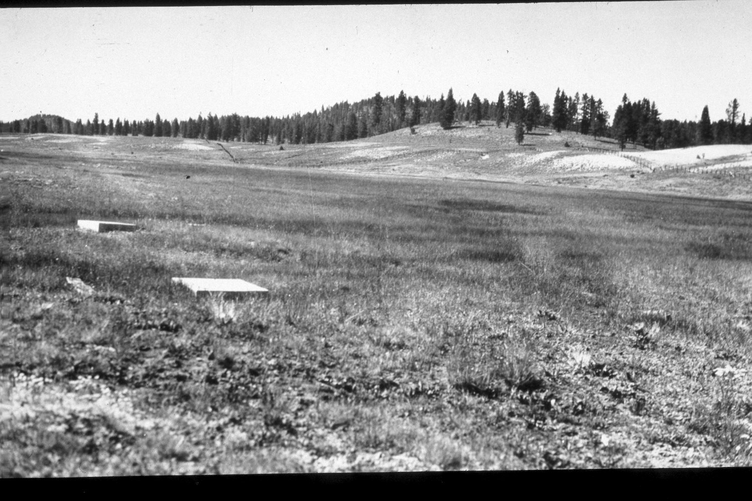
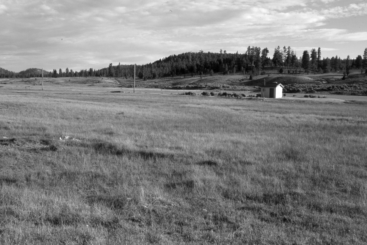
East Creek
1940
2003
Description:
Plate 217X. East Creek 1940 - 2003 Viewed southeast across East Creek. This area is fenced to exclude livestock, as it is the water source for Bryce Canyon National Park. The fenced area, however, is grazed by elk and mule deer. The concrete squares seen in the original image cap spring developments. Today, those features have disintegrated and the decomposed concrete is hidden from view by the tall grass. The Park Service has added a gravel road, electricity, and two new well houses - - one of which is just off the photo to the left. The fence behind the well house has been realigned since 1940. Despite selective logging, ponderosa pine has increased on the distant hillsides. Rubber rabbitbrush has increased at the base of the first hill (photo right-center) and on the disturbed area around the well house.
Photo Information:
U.S. Geological Survey photograph taken by H.E. Gregory (No. 979) in 1940; retake by Charles E. Kay on August 3, 2003 - - Photo No. 5198-19A. Original photograph held by U.S. Geological Survey Photographic Library, Denver, CO.
Vegetative Community:
Conifer, Dry Meadow
Location:
South West: Section 34, Range 4 West, Township 36 South; UTM 393200E, 4165600N; elevation 7,760 ft.