Duck Lake Snow Course
1936
2005
Description:
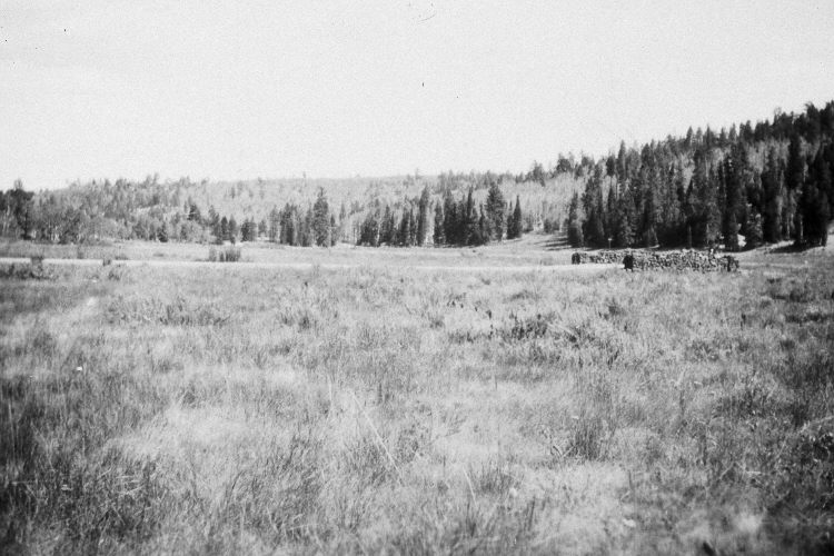
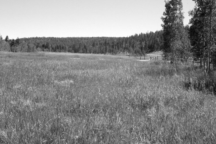
Plate 1085X. Duck Lake Snow Course 1936 – 2005 Viewed east-southeast from the end of the old snow survey course at Duck Lake. In 1936, a series of snow courses were established throughout southern Utah by what is today the Natural Resources Conservation Service (NRCS). When they were first set-up, photographs were taken at each snow survey site. Although the snow course at Duck Lake is no longer used by NRCS, the photos remain. Silver sage has declined in the foreground. The meadow is mostly smooth brome, Kentucky bluegrass, and timothy. The road from left to right goes to Duck Lake Campground. Utah Highway 143 is on the right. The stone bridge in the 1936 image has been replaced with a culvert, over which the Forest Service has built a metal gate to close the campground. In the distance, spruce, Douglas fir, and white fir have increased, while aspen has declined. Aspen on the right and around the edge of the meadow, though, regenerated 30 years ago when mule deer numbers were low, but not before or since due to repeated ungulate browsing (Kay and Bartos 2000). Both the beginning and ending 10 ft. steel pipes and signs are still present on the old snow course.
Photo Information:
Original photograph (NRCS – 205) taken on September 8, 1936; retake by Charles E. Kay on August 31, 2005 - - Photo No. 5536-25. Original photograph held by the Snow Survey Supervisor, Natural Resources Conservation Service, Salt Lake City, UT.
Vegetative Community:
Sagebrush, Dry Meadow, Conifer, Aspen
Location:
South West: Section 12, Range 8 West, Township 38 South; UTM 349800 E, 4153500 N; elevation 8,550 ft.