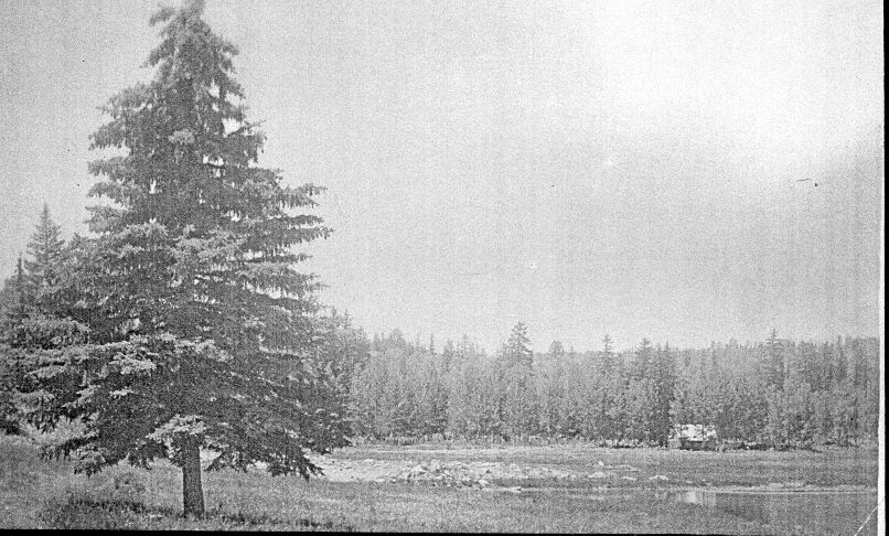
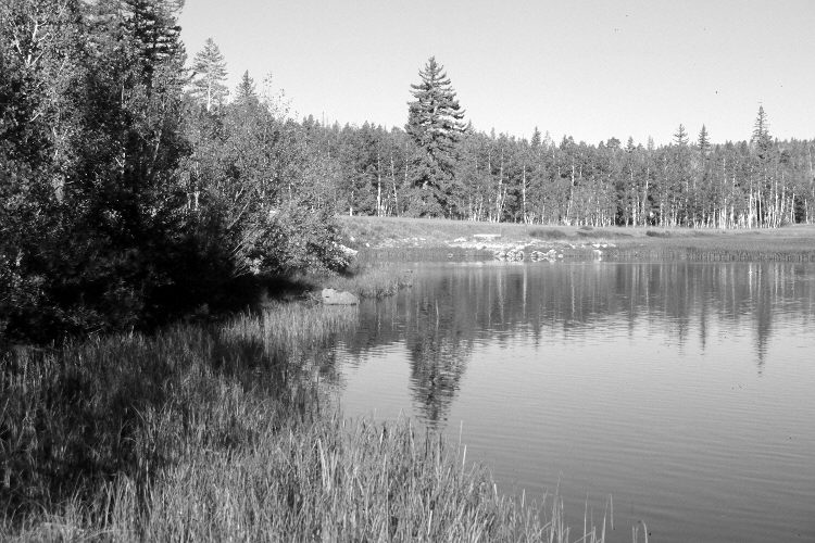
Duck Lake
1910
2005
Description:
Plate 1080X. Duck Lake 1910 – 2005 Viewed west to Duck Lake. The 1910 photograph was taken before the dam was built on the lake’s outlet. That dam raised the water level three to four feet and flooded-out the original camera station. The view is of the spring-inlet area. Utah Highway 143 on the south side of the lake has been realigned, widened, and paved. The large spruce on the left was removed during construction. In general, though, spruce and other conifers have increased, while aspen has declined. Some aspen,however, regenerated 30 years ago when mule deer numbers were low, but not before or since due to repeated herbivory (Kay and Bartos 2000).
Photo Information:
Original photograph taken ca. 1910; retake by Charles E. Kay on August 31, 2005 - - Photo No. 5533-27. Original photograph held by the Kanab Museum, Kanab, UT.
Vegetative Community:
Conifer, Aspen
Location:
South West: Section 12, Range 8 West, Township 38 South; UTM 350300 E, 4153300 N; elevation 8,535 ft.