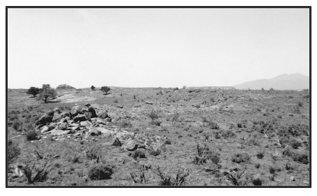
Dry Valley Near Casa Colorado
1927
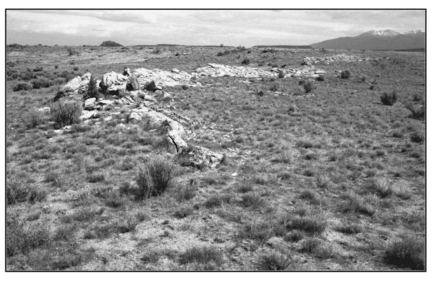
1999
Description:
DRY VALLEY NEAR CASA COLORADO ROCK This site is on an escarpment overlooking Hatch Wash approximately 1.5 miles southwest of Casa Colorado Rock. It is located about .4 mile west of an oil pipeline. The view is north across public lands administered by the Bureau of Land Management. Soils at this site are classified as Begay-rock outcrop-Mido complex. These soils occur on structural bench escarpments along drainage ways. Specific soils at the exact site tend toward a rock outcrop-Mido loamy fine sand. Soils here do not reach typical Mido soil depths as evidenced by the rock outcrops appearing in the photographs. It is estimated that soil depths in the area from the immediate foreground to the top of the escarpment range from 6 to 40 inches. Mido soils have rapid permeability and low water supplying capability. Average annual precipitation at this location ranges from 10 to 12 inches. Overall plant densities appear to have increased here, but shrub frequency has decreased in favor of grass species. The most striking difference, however, between the 1927 and 1999 images is the health and vigor of the plant community as a whole which has resulted in a much improved ground cover situation. Some of the plant species present include juniper, sagebrush, fourwing saltbush, winterfat, snakeweed, Indian ricegrass, curlygrass, blue grama, needle and thread grass, cheatgrass, and threeawn.
Photo Information:
Photograph Number: Baker No.216 Original: Date: 1927 (- A) Photographer: A.A. Baker Source: U.S. Geological Survey, Denver, Colorado Retake: Date: May 13, 1999 (- B) Photographer: Earl Hindley Source: San Juan County
Vegetative Community:
Sagebrush
Location:
San Juan: NE1/4SW1/4 Section 19 T.30S., R.24E.