Doctor Creek Cove Fish Lake
1920
2000
Description:
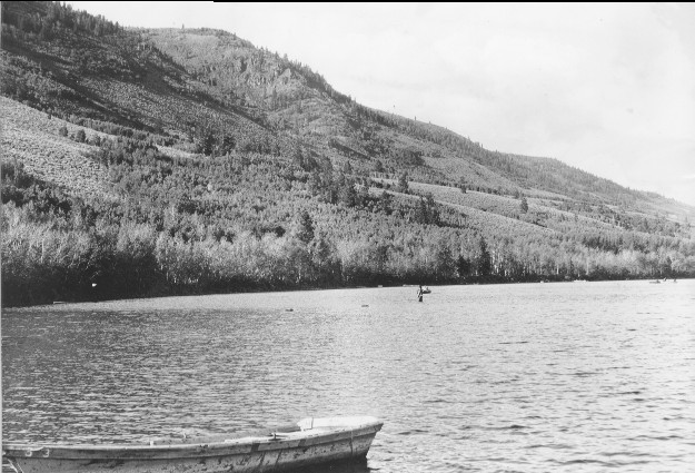
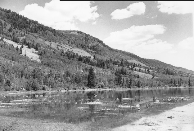
Plate 200. DOCTOR CREEK COVE FISH LAKE 1920-2000 The shoreline at this site has changed dramatically. Instead of the wave swept gravel beach seen in the original photo, the area is now largely a swamp. There appears to have been a slight drop in lake level and Doctor Creek appears to have washed-in material at this site. It is not known if this infilling is natural or a result of the development that has taken place since the original photo. In addition to new roads and summer homes, a diked marina built by the Lakeview Lodge now extends well out into the Lake just south of this photopoint -- see Plate 9. The lake level may also have been lowered when the dam on the outlet failed and/or the outlet was channelized. Aspen on the distant hillside has matured, increasing in height but along the shoreline it is not doing as well -- this too may be related to recent construction activity. Conifers and curlleaf mountain mahogany have both increased in height and density as would be expected in the absence of fire. The few Douglas fir seen in the original photo were restricted to fire refugia. Prior to European influence, Fish Lake was a major gathering point for Native Americans and aboriginal fires were once common. This area is also called Tabiona Bay after a native leader who signed a peace treaty here in 1873. This photoset is similar to Plate 6.
Photo Information:
U.S. Forest Service photo 253133 taken in 1920; retake by Charles E. Kay on July 28, 2000 - - Photo No. 4640-33A; Original photo (2300 Fishlake-19) held by the Forest Service Regional Office Photographic Collection housed at Weber State University, Ogden, UT.
Vegetative Community:
Riparian, Wet Meadow, Aspen, Mountain Brush, Conifer
Location:
South Central: Section 19, Range 2 E, Township 26 S; UTM 435900 E, 4265350 N; elevation 8,843 ft; viewed northwest.