Desert View
1921
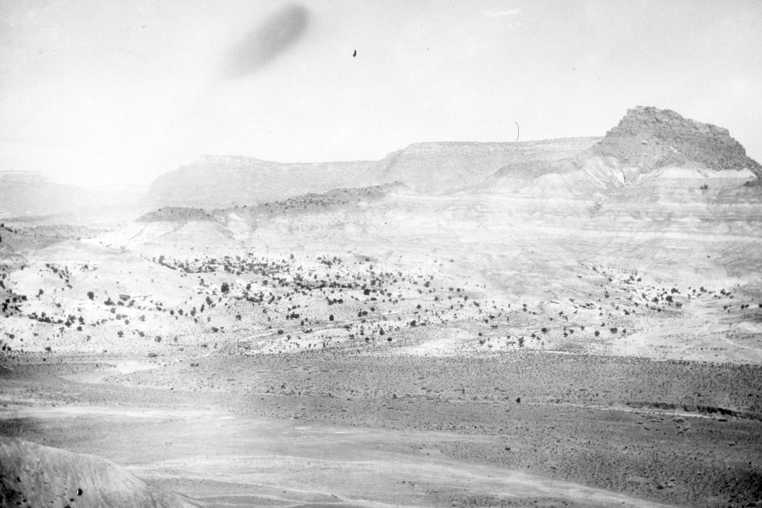
2004
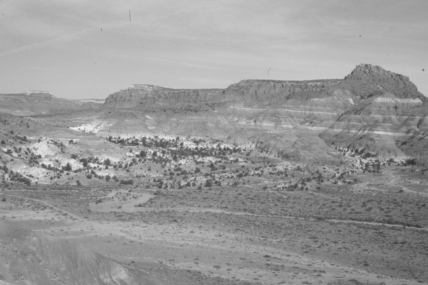
Description:
Plate 445X. Desert View 1921 – 2004 Viewed northwest near the old Paria townsite. Plates 444x and 445x form a panorama. Juniper has increased. Other shrubs include cliff rose, Utah serviceberry, Mormon tea, Apache plume, Wyoming big sage, rubber rabbitbrush, shadscale, and greasewood. The roads in the original and the retake lead to the old Paria townsite, which is to the northeast of the photopoint - - see Plate 442x. The square, fenced area on the far side of the draw in the retake is the new Paria cemetery. The cemetery at the original townsite was being threatened by erosion, so those bodies were exhumed and reinterred at this safer location.
Photo Information:
Original photograph taken by R.C. Moore (No. 156) in 1921; retake by Charles E. Kay on May 16, 2004 - - Photo No. 5310-26. Original photograph held by the U.S. Geological Survey Photographic Library, Denver, CO.
Vegetative Community:
Juniper, Salt Desert Shrub
Location:
South West: Section 18, Range 1 West, Township 41 South; UTM 416000 E, 4121650 N; elevation 5,200 ft.