Crystal Creek
1942
2006
Description:
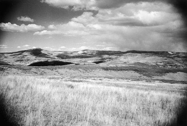
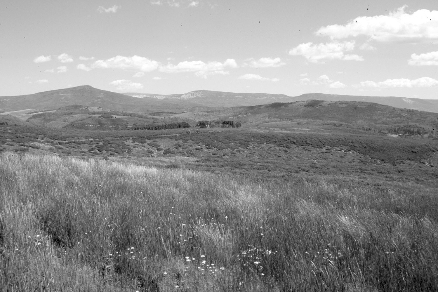
Plate 1315X. Crystal Creek 1942 – 2006 Viewed northeast across the upper reaches of Crystal Creek on Cedar Mountain. Black Mountain (10,400 ft) is on the left, Blowhard Mountain (10,596 ft) is on the skyline photo-center, and Miners Peak (9,243 ft) is on the right below the skyline. Note the road cut for Utah Highway 14 below Blowhard Mountain in both the 1942 and 2006 images. The foreground is mostly slender wheatgrass. The low, dark-colored shrubs in the mid-distance are snowberry and they appear to have increased. Aspen has not successfully regenerated in many years due to excessive ungulate herbivory (Ohms 2003).
Photo Information:
Original photograph taken by Gregory (No. 1136) in 1942; retake by Charles E. Kay on July 12, 2006 - - Photo No. 5686-9. Original photograph held by the U.S. Geological Survey Photographic Library, Denver, CO.
Vegetative Community:
Aspen
Location:
South West: Section 30, Range 10 West, Township 38 South; UTM 322300 E, 4150000 N; elevation 9,100 ft.