Cottonwood Creek
1944
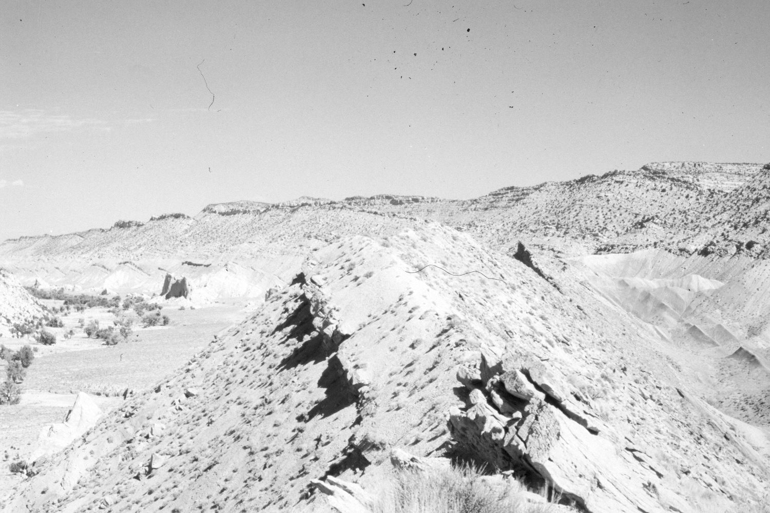
2004
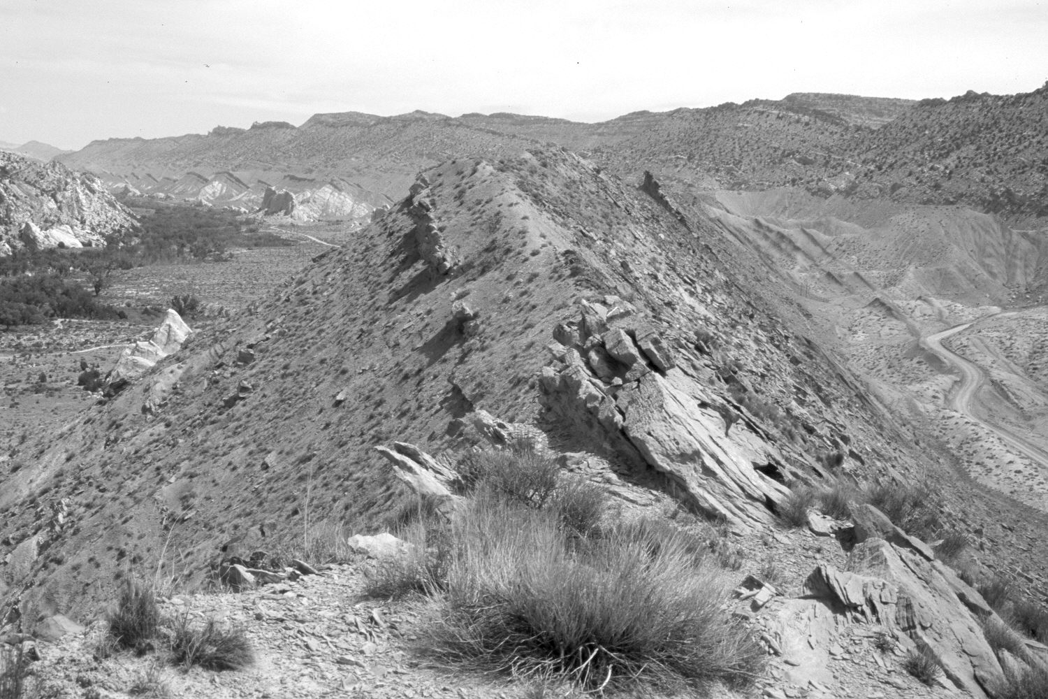
Description:
Plate 453X. Cottonwood Creek 1944 – 2004 Viewed northeast up Cottonwood Creek from The Cockscomb. This is just above the confluence with the Paria River - - see Plate 452x. Cottonwoods and willows have increased, despite yearly livestock use. The area was actively being grazed by cattle in 2004. A high-voltage powerline and road have been added since the earlier photo.
Photo Information:
Original photograph taken by H.E. Gregory (No. 1214) in 1944; retake by Charles E. Kay on May 16, 2004 - - Photo No. 5315-8. Original photograph held by the U.S. Geological Survey Photographic Library, Denver, CO.
Vegetative Community:
Riparian
Location:
South West: Section 21, Range 1 West, Township 41 South; UTM 418150 E, 4121050 N; elevation 5,010 ft.
January 2018