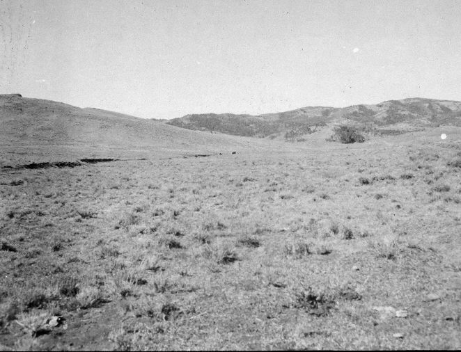
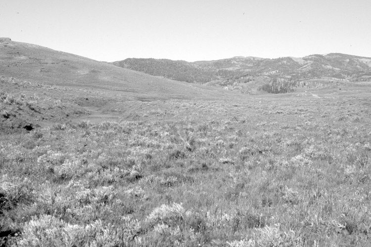
Corral Hollow
1964
2005
Description:
Plate 920X. Corral Hollow 1964 – 2005 Viewed southwest down Corral Hollow north of Panguitch Lake. The stream banks appear more vegetated today than in the past. The area was not as heavily grazed in 2005 as it was in 1964. Silver sage and rubber rabbitbrush appear to have increased, as have conifers and curlleaf mountain mahogany in the distance. The area was actively being grazed by cattle in 2005.
Photo Information:
U.S. Forest Service photograph (unnumbered) taken on September 11, 1964; retake by Charles E. Kay on June 25, 2005 - - Photo No. 5476-3. Original photographs, negatives, and reports held in the range files on the Cedar City Ranger District, Dixie National Forest, Cedar City, UT.
Vegetative Community:
Riparian, Sagebrush, Mountain Brush
Location:
South West: Section 36, Range 7 West, Township 34 South; UTM 360000 E, 4186600 N; elevation 7,870 ft.