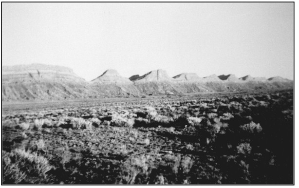
Comb Ridge
ca. 1950
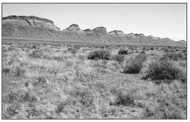
1998
Description:
COMB RIDGE This site is approximately .6 mile southwest of Sweet Springs. The view is southeast across public land administered by the Bureau of Land Management. Without foreground indicators it was difficult to match the exact location, but the retake is within 100 feet of the original photopoint. Soils here are classified as Mivida, a deep (over 60 inches) fine sandy loam with a moderately low or moderate water supplying capability. Average annual precipitation is 6 to 8 inches. Shrub species, fourwing saltbush and shadscale appear to have similar characteristics such as frequency and ground cover in both the 1950s and 1998 images. However, grass and forb species including curlygrass, Indian ricegrass and globemallow have increased significantly in frequency and groundcover. Other plants present are snakeweed, cheatgrass and Russian thistle. This site is still grazed by cattle.
Photo Information:
Photograph Number: San Juan County Historical Commission No. 22719 Original: Date: ca. Mid 1950s (- A) Photographer: Kent Frost Source: San Juan County Historical Commission Retake: Date: July 21, 1998 (- B) Photographer: Earl Hindley Source: San Juan County
Vegetative Community:
Salt Desert Shrub
Location:
San Juan: SW1/4NE1/4 Section 26 T.39S., R.20E.