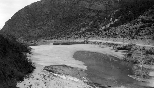
Coal Creek
1934
2006
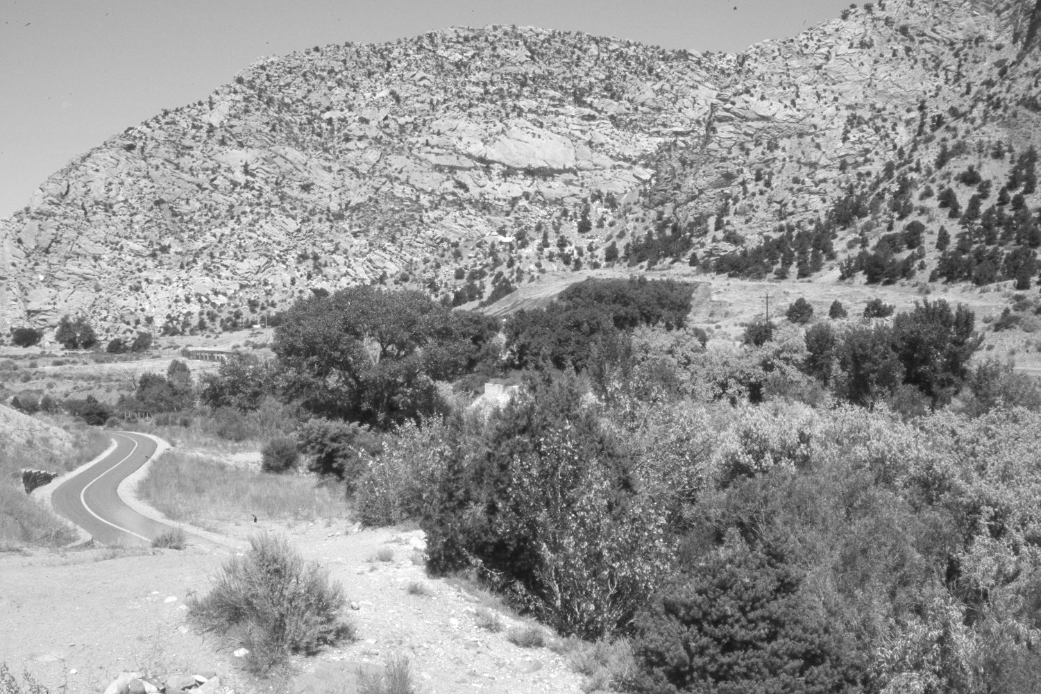
Description:
Plate 1340X. Coal Creek 1934 – 2006 Viewed northwest (down stream) to the lower sediment-retention dam on Coal Creek east of Cedar City. Dense woody riparian vegetation now blocks the original camera station, so the retake was made from the nearest open area which is 50 feet higher and 150 feet further to the south. Willows and cottonwoods have increased, as has pinyon and juniper in the distance. A bike path has recently been built on the south side of the stream (photo lower-left), while across the creek, Utah Highway 14 has been widened and paved. The dam is still functional but is hidden from view in the retake by the lush growth of riparian vegetation.
Photo Information:
U.S. Forest Service photograph (unnumbered) taken in 1934; retake by Charles E. Kay on July 17, 2006 - - Photo No. 5695-10. Original photograph held by Southern Utah University Archives and Special Collections, Cedar City, UT.
Vegetative Community:
Riparian, Pinyon, Juniper
Location:
South West: Section 18, Range 10 West, Township 36 South; UTM 320750 E, 4171250 N; elevation 6,040 ft.