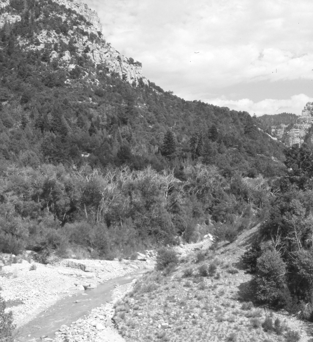
Coal Creek
1920

2006
Description:
Plate 1355X. Coal Creek 1920 – 2006 Viewed southeast up Coal Creek at the mouth of Last Chance Canyon. Martins Flat is on the left. The toe on the hill closest the camera on the right has been removed and Coal Creek channelized to facilitate the realignment of Utah Highway 14 off the photo to the right. The old road up Coal Creek used to be on the left (north) side of the canyon but Utah Highway 14 was moved to the south (right) side of the canyon when the road was widened and paved. The photopoint is on a rock ledge 50 feet above the parking area at the mouth of Last Chance Canyon. Pinyon, juniper, oakbrush, conifers, curlleaf mountain mahogany, Utah serviceberry, and birchleaf mountain mahogany have all increased, as have forest fuels. Cottonwoods have increased along Coal Creek except where the stream has been channelized.
Photo Information:
U.S. Forest Service photograph (150382) taken by E.S. Shipp in 1920; retake by Charles E. Kay on July 17, 2006 - - Photo No. 5700-10. Original photograph (2310 – Fishlake – 14) held in the Forest Service Regional Office Photographic Collection housed at Weber State University, Ogden, UT.
Vegetative Community:
Pinyon, Juniper, Conifer, Mountain Brush, Riparian
Location:
South West: Section 26, Range 10 West, Township 36 South; UTM 327700 E, 4167650 N; elevation 6,830 ft.