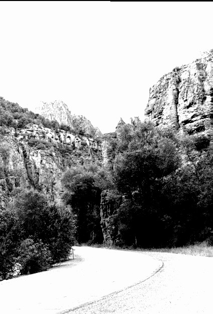
Clear Creek Narrows
1920
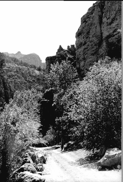
2000
Description:
Plate 250. CLEAR CREEK NARROWS 1920-2000 Viewed west up Clear Creek at the beginning of the narrows. Riparian trees now block the original view and Utah Highway 4 has been built up the canyon - - this road has since been replaced by I-70 as the main travel route.
Photo Information:
U.S. Forest Service photo 150381 by E.S. Shipp in 1920; retake by Charles E. Kay on August 4, 2000 - - Photo No. 4664-32A; Original photo (2310 Fishlake-15) held by Forest Service Regional Office Photographic Collection housed at Weber State University, Ogden, UT.
Vegetative Community:
Riparian
Location:
South Central: Section 32, Range 4 ½ W, Township 25 S; 380300 E, 4270900 N; elevation 6,000 ft.
January 2018