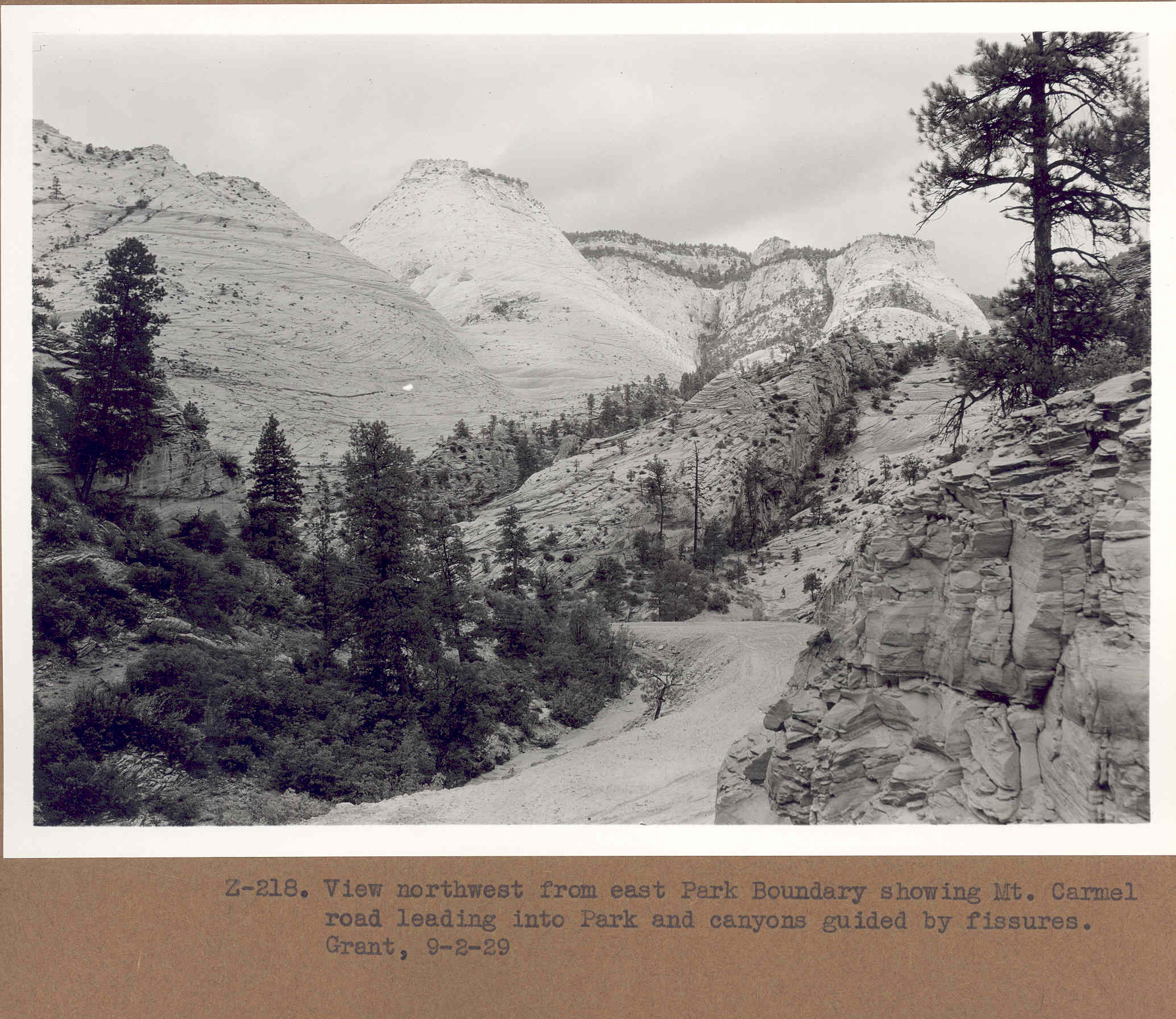
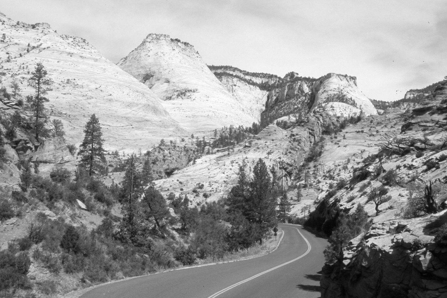
Clear Creek
1929
2006
Description:
Plate 1174X. Clear Creek 1929 – 2006 Viewed north-northwest down Clear Creek in Zion National Park. The photopoint is on top of the hair-pin curve about a mile west of Checkerboard Mesa. Utah Highway 9 has been widened and paved. The original rock-cut has been enlarged. The tree on top of the cliff in the right-center edge of the 1920 image has died and fallen exposing its roots in the retake. Similarly, the tall tree on the left-center edge of the original photo has died and fallen. Clear Creek is to the left of the road. The shrubs are mostly oakbrush and bitterbrush. The road-fill has naturally revegetated including the establishment of several ponderosa pine. Otherwise, vegetation change has been minimal.
Photo Information:
Original photograph taken by grant (Z-218) on September 2, 1929; retake by Charles E. Kay on June 3, 2006 - - Photo No. 5625-32. Original photograph (Zion 12366) held by the National Park Service, Zion National Park, Springdale, UT.
Vegetative Community:
Mountain Brush, Conifer
Location:
South West: Section 18, Range 9½ West, Township 41 South; UTM 331550 E, 4121000 N; elevation 5,520 ft.