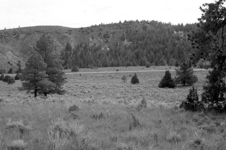
Clayton Dugway
1957
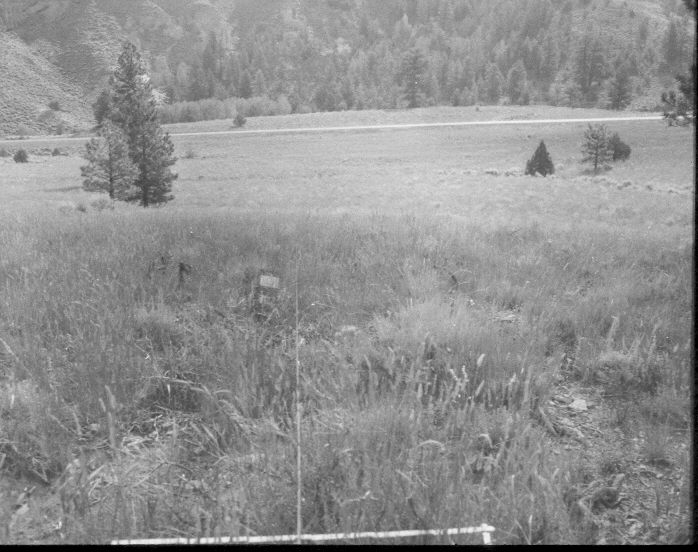
2005
Description:
Plate 1025X. Clayton Dugway 1957 – 2005 Viewed southeast along line one of the Parker Three-Step Transect at Clayton Dugway northeast of Panguitch Lake. Utah Highway 143 is in the distance. The area in the foreground was root-plowed and reseeded with crested wheatgrass a few years before the first image was made. With time, however, mountain big sagebrush has reinvaded the site. Bitterbrush is also present. Panguitch Creek is at the base of the hill in the distance. Ponderosa pine and juniper have increased.
Photo Information:
U.S. Forest Service photograph (unnumbered) taken on August 22, 1957; retake by Charles E. Kay on August 3, 2005 - - Photo No. 5514-5. Original photographs, negatives, and narrative reports held in the range files on the Cedar City Ranger District, Dixie National Forest, Cedar City, UT.
Vegetative Community:
Sagebrush, Mountain Brush, Conifer, Juniper
Location:
South West: Section 25, Range 7 West, Township 35 South; UTM 359800 E, 4177850 N; elevation 8,040 ft.