Center Creek
1965
2003
Description:
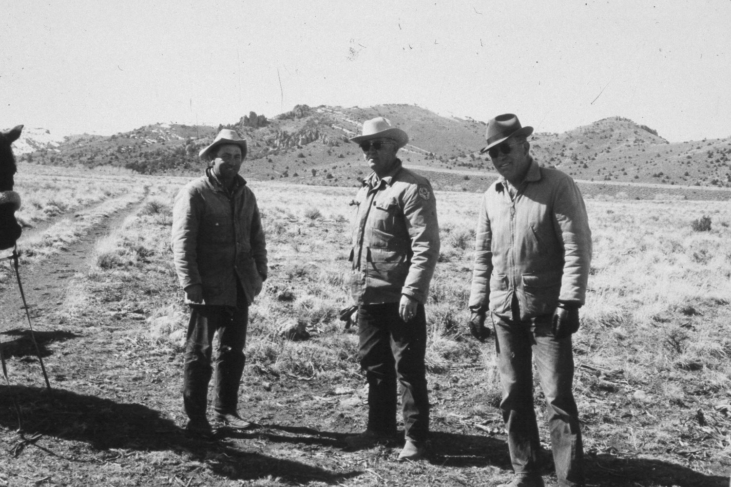
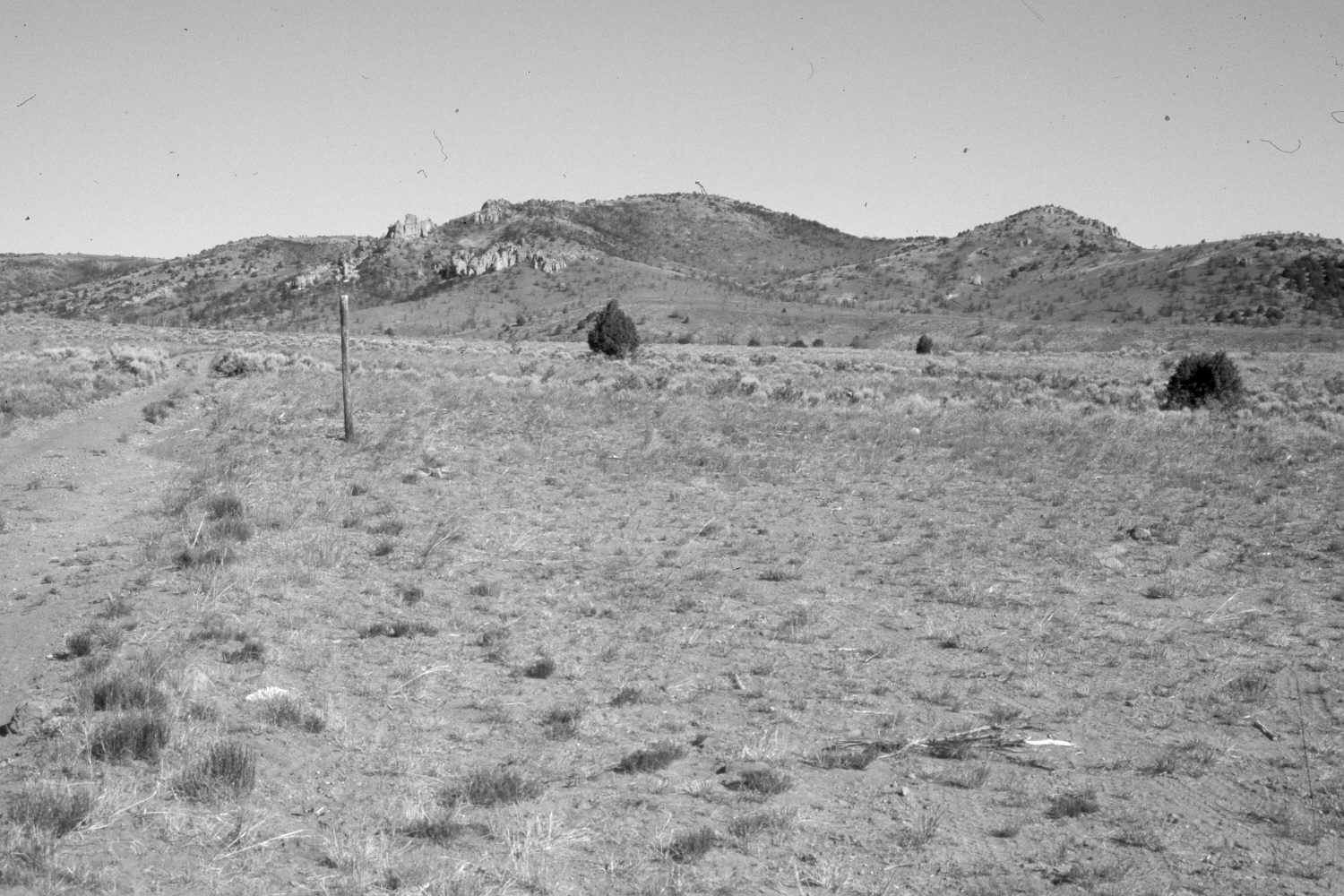
Plate 120X. Center Creek 1965-2003 Viewed northwest up Center Creek at the junction of USFS roads 190 and 191. Pinyon and juniper have increased on the distant hillsides, but much of that area was burned by the 78,000 acre Sanford fire in 2002. Sagebrush has also increased except where it has been root-plowed and reseeded. The area in the foreground has been used as a staging area. The most common native grass is needle and thread (Stipa comata). The jeep trail on the left has eroded since the earlier photo. The wooden post in the retake is for a USFS road sign that has been vandalized. Shown in the original photograph are Howard Hatch, Frank Daly, and George Proctor. Note the cottonwoods along Center Creek in the distance, which flows from left to right.
Photo Information:
U.S. Forest Service photo (unnumbered) taken by G. Glade Quilter on March 30, 1965; retake by Charles E. Kay on June 22, 2003 - - Photo No. 5162-4A. Original photograph held by Southern Utah University Archives and Special Collections, Cedar City, UT.
Vegetative Community:
Sagebrush, Riparian
Location:
South West: Section 29, Range 3 West, Township 34 South; UTM 399000E, 4186200 N; elevation 7,940 ft.