Cedar Breaks Snow Course
1936
2006
Description:
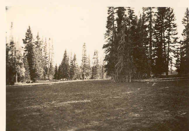
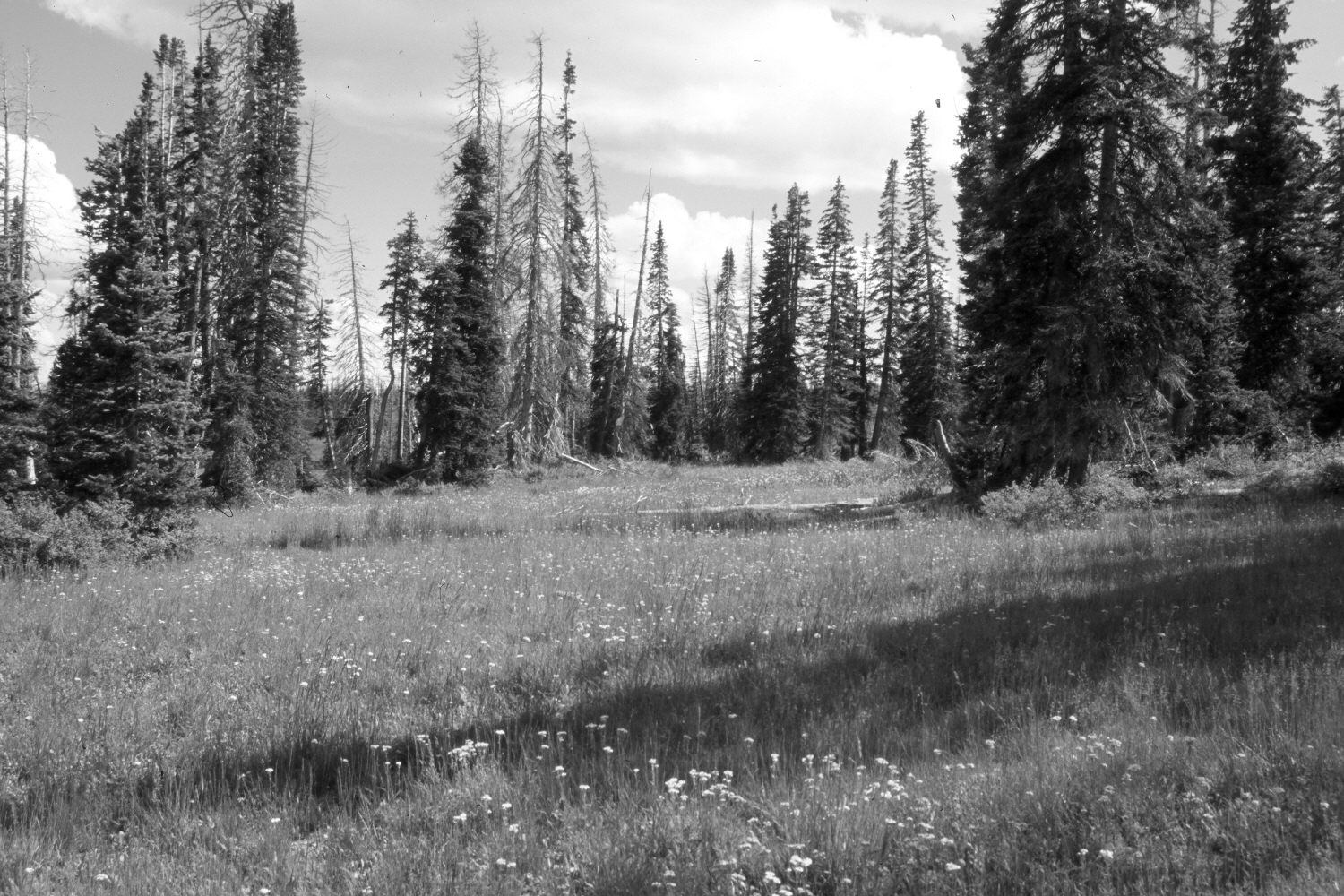
Plate 1372X. Cedar Breaks Snow Course 1936 – 2006 Viewed south from the turning point on the old snow survey course outside Cedar Breaks National Monument - - see Plates 1369x to 1371x. The foreground is more vegetated today than in the past despite annual grazing by domestic sheep. Conifers have increased, though, many of the older spruce were recently killed by insects and disease.
Photo Information:
Original photograph (NRCS-208) taken on September 7, 1936; retake by Charles E. Kay on August 3, 2006 - - Photo No. 5707-13. Original photograph held by the Snow Survey Supervisor, Natural Resources Conservation Service, Salt Lake City, UT.
Vegetative Community:
Conifer, Dry Meadow
Location:
South West: Section 12, Range 9 West, Township 37 South; UTM 338450 E, 4163200 N; elevation 10,220 ft.