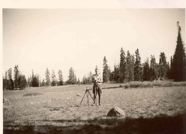
Cedar Breaks Snow Course
1936
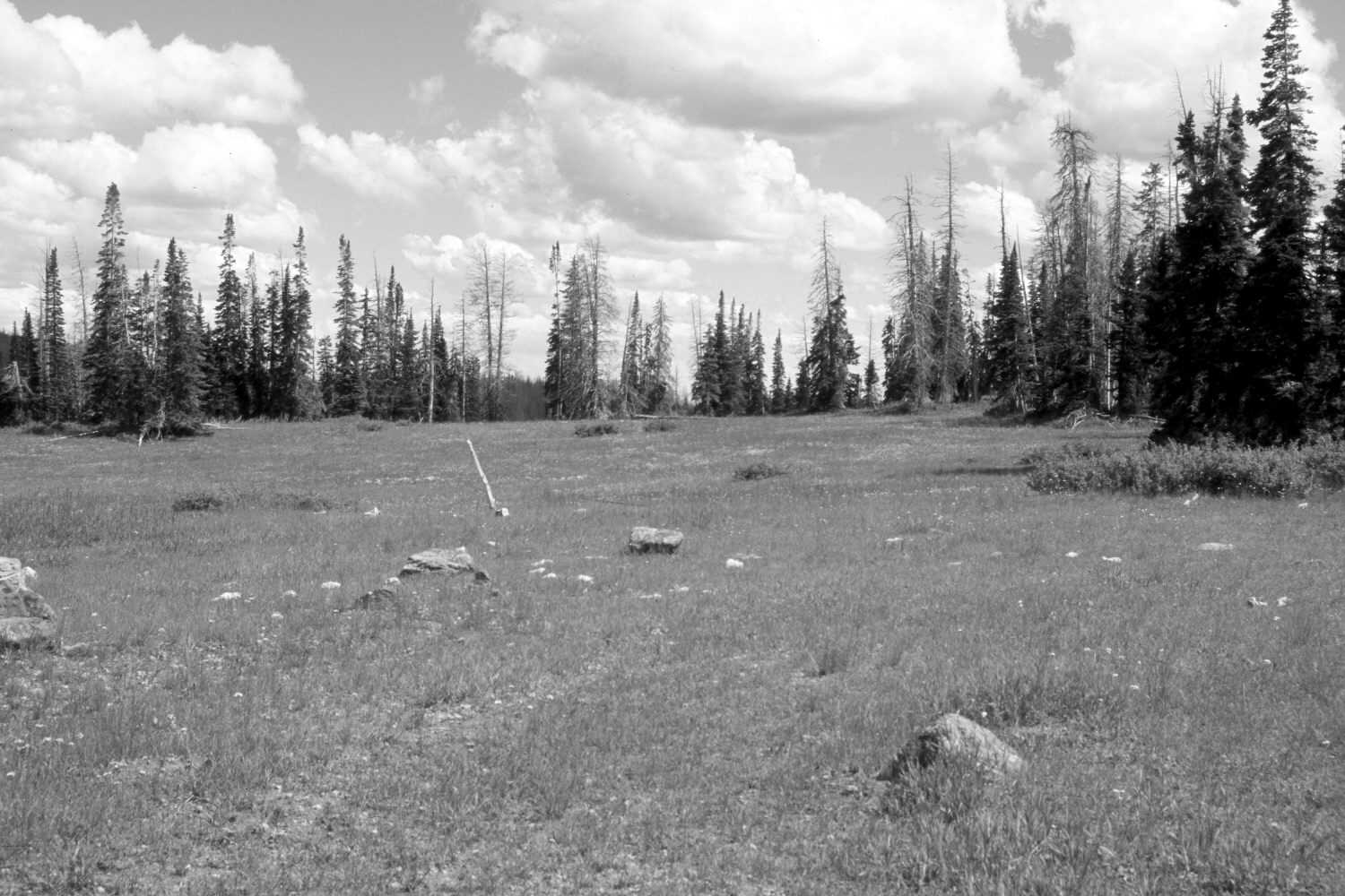
2006
Description:
Plate 1369X. Cedar Breaks Snow Course 1936 – 2006 Viewed southeast from the starting point of the old Cedar Breaks Snow Course at the head of Long Valley. The former snow course is to the east and south of the southeast corner of Cedar Breaks National Monument and as such, is actually on the Dixie National Forest. The area between the camera and the one remaining, up-right fence post in the retake was once part of the Long Valley Exclosure built by the Forest Service in 1960 - - see Plates 1096x and 1105x. The area inside the exclosure was disced, pitted, and reseeded, which explains why the foreground rocks in the original image do not line-up with the rocks in the retake. The exclosure has not been maintained since the 1970’s allowing access by domestic sheep. The foreground is mostly smooth brome, which was planted. Conifers have increased, but many of the old spruce were recently killed by insects and disease. The low-growing shrubs are currants.
Photo Information:
Original photograph (NRCS-210) taken on September 7, 1936; retake by Charles E. Kay on August 3, 2006 - - Photo No. 5705-32. Original photograph held by the Snow Survey Supervisor, Natural Resources Conservation Service, Salt Lake City, UT.
Vegetative Community:
Conifer, Dry Meadow
Location:
South West: Section 12, Range 9 West, Township 37 South; UTM 338300 E, 4163600 N; elevation 10,220 ft.