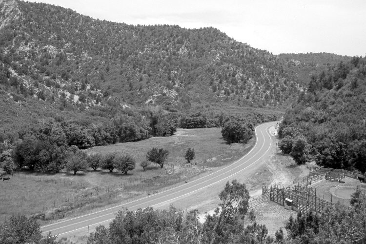
Carroll Ranch
1915
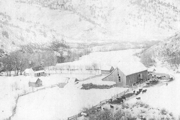
2005
Description:
Plate 891X. Carroll Ranch 1915 – 2005 Viewed south-southeast down the East Fork of the Virgin River to Carrol Ranch at the mouth of Grassy Hollow north of Glendale, Utah. U.S. Highway 89 has been realigned, widened, and paved. The barn in the initial image has been moved 150 yards to the west (right) up Grassy Hollow. Box elder, cottonwoods, and willows have increased along the river, while pinyon, juniper, oakbrush, Utah serviceberry, bitterbrush, and true mountain mahogany have increased on the hillsides. Ponderosa pine has established on some sites. Pinyon and juniper have also increased around the original camera station, so the retake was made from the nearest open area.
Photo Information:
Original photograph taken ca. 1915; retake by Charles E. Kay on June 21, 2005 - - Photo No. 5463-13. Original photograph held by the Kanab Museum, Kanab, UT.
Vegetative Community:
Riparian, Pinyon, Juniper, Oakbrush, Mountain Brush, Conifer
Location:
South West: Section 2, Range 7 West, Township 40 South; UTM 358450 E, 4135850 N; elevation 6,200 ft.