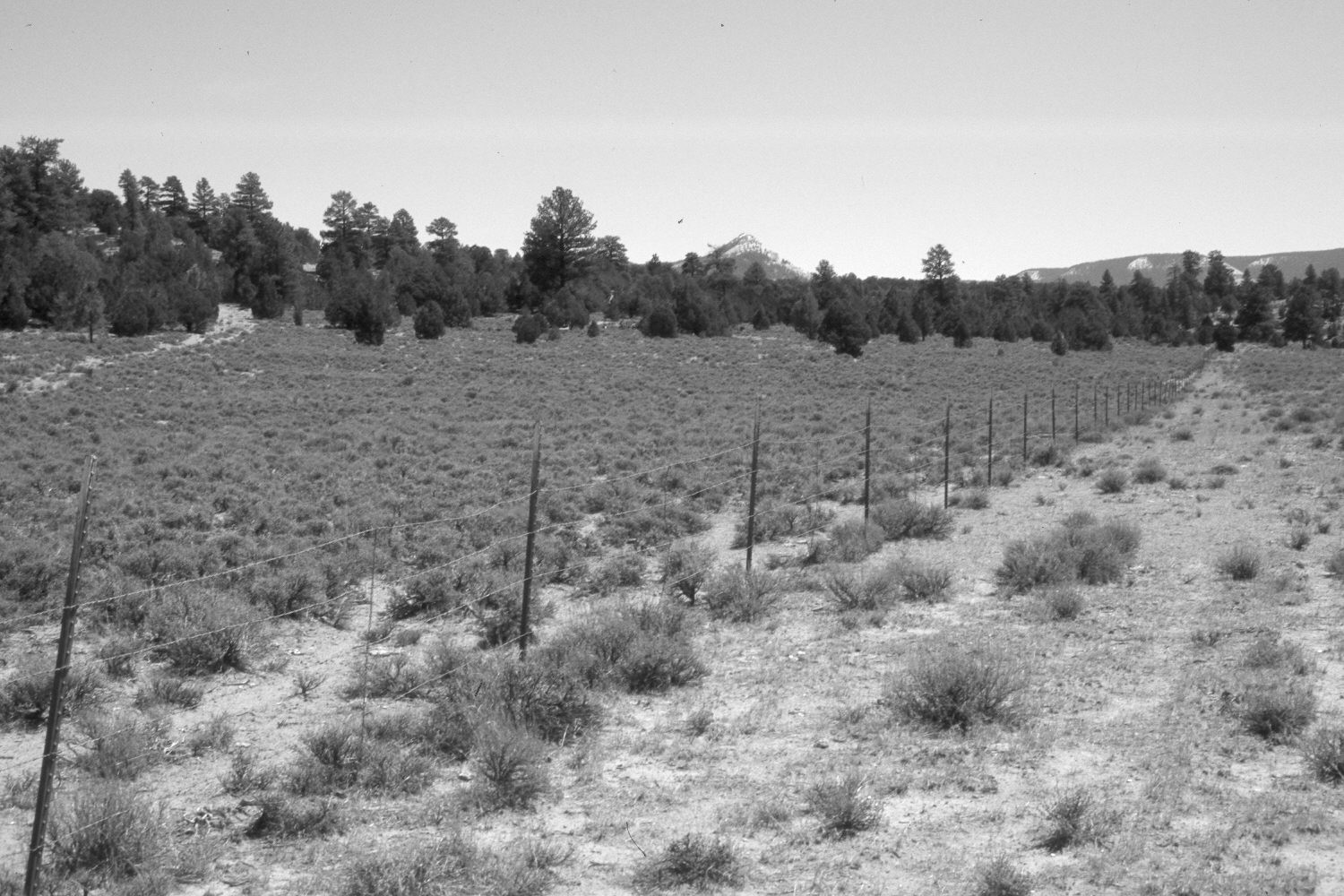
Cameron Wash Allotment Fence
1963
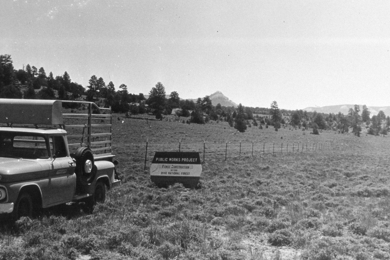
2002
Description:
Plate 116X. Cameron Wash Allotment Fence 1963-2002 Viewed east along the Cameron Wash Allotment Fence. This view is similar to Plate 115x but the camera is turned a little more to the north (left). The fence had just been built when the original photo was taken. The sign was not permanent but apparently was moved form place to place to document various range improvement projects. The density of black sagebrush is less on the right side of the fence today as that area was not root-plowed and reseeded during the early 1960’s. Vehicle access for fenceline construction has also reduced the density of black sage plants immediately south (right) of the fence. Pinyon, juniper, and ponderosa pine have all increased on the distant hillsides.
Photo Information:
U.S. Forest Service photograph (unnumbered) taken in June 1963; retake by Charles E. Kay on August 8, 2002 - - Photo No. 5024-11. Original photograph held by Southern Utah University Archives and Special Collections, Cedar City, UT.
Vegetative Community:
Sagebrush, Pinyon, Juniper, Conifer
Location:
South West: Section 16, Range 2 West, Township 35 South; UTM 410150E, 4180400N; elevation 7,560 ft.