Cameron Wash
1963
2002
Description:
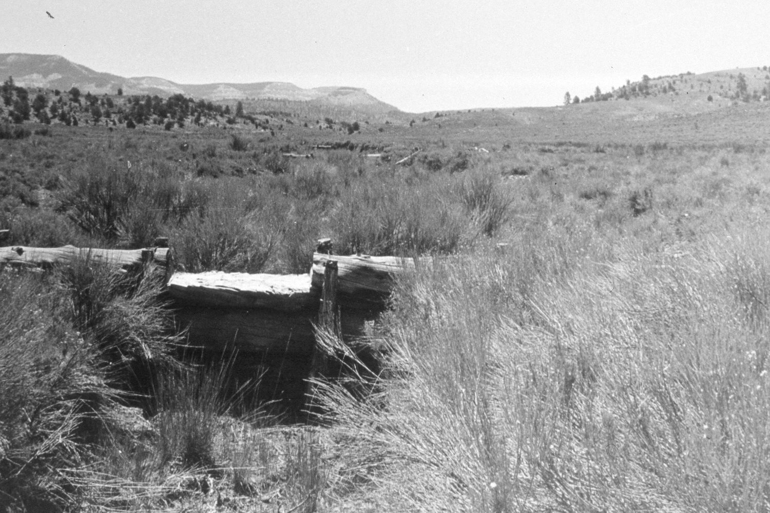
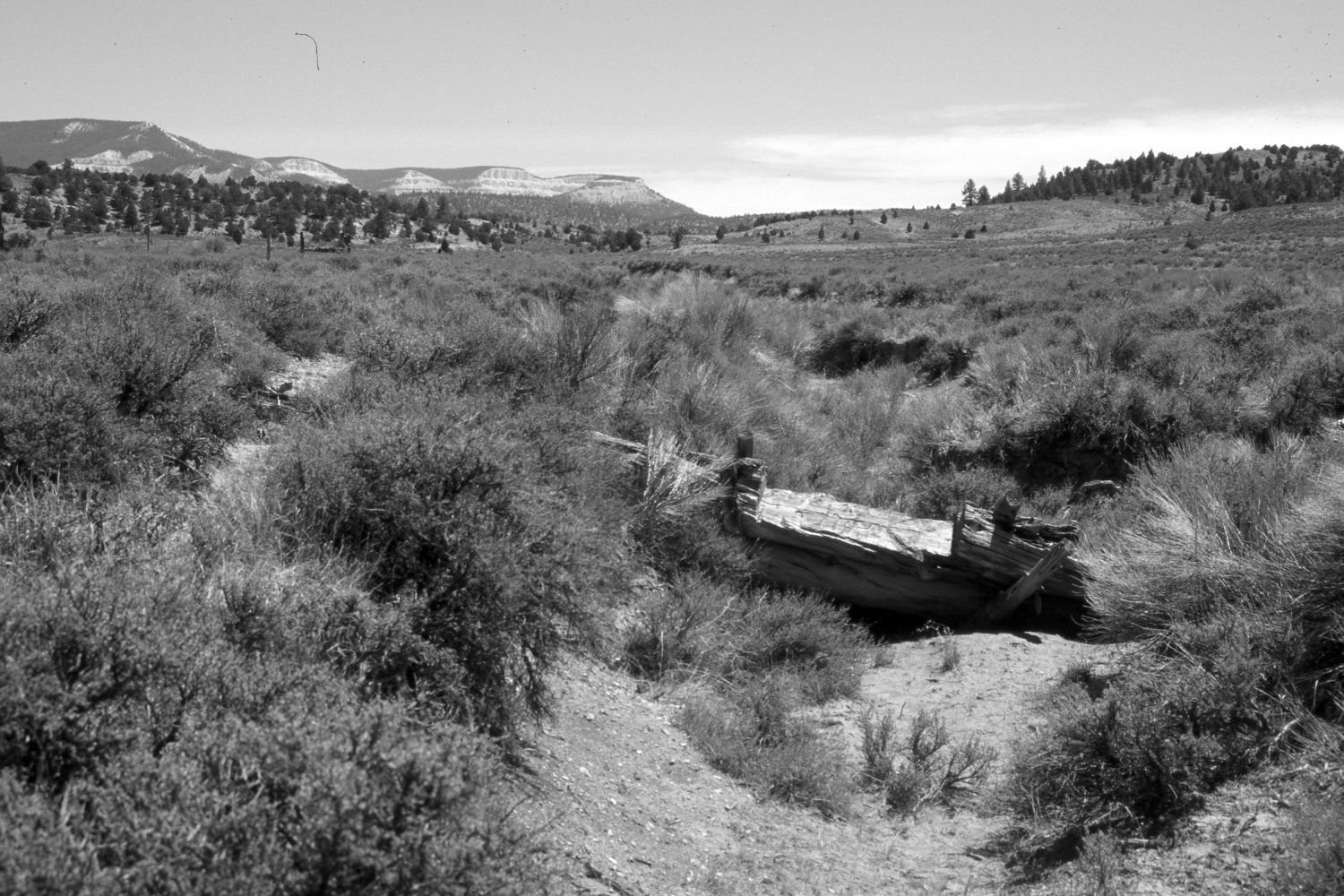
Plate 117X. Cameron Wash 1963-2002 Viewed southeast up Cameron Wash with Table Cliff Plateau and Powell Point in the distance. The main arroyo in Cameron Wash is off the photo to the left, while the gully in the photograph flows in from the south. The 1963 image shows a wooden check dam that was installed by the CCC’s during the 1930’s to show gully erosion. That structure has since fallen into disrepair, but there is no evidence of flows or erosion down the arroyo in recent years. The area to the right of the draw was root-plowed and reseeded during the early 1960’s, but has since been invaded by rubber rabbitbrush and black sage. The area to the left of the arroyo, however, was not treated and is primarily black sage. Pinyon, juniper, and ponderosa pine have all increased on the distant hills.
Photo Information:
U.S. Forest Service photograph (unnumbered) taken in 1963; retake by Charles E. Kay on August 8, 2002 - - Photo No. 5024-17. Original photograph held by Southern Utah University Archives and Special Collections, Cedar City, UT.
Vegetative Community:
Sagebrush, Pinyon, Juniper, Conifer
Location:
South West: Section 17, Range 2 West, Township 35 South; UTM 410100E, 4180300N; elevation 7,540 ft.