Bunker Creek
1957
2005
Description:
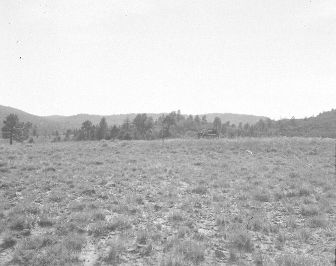
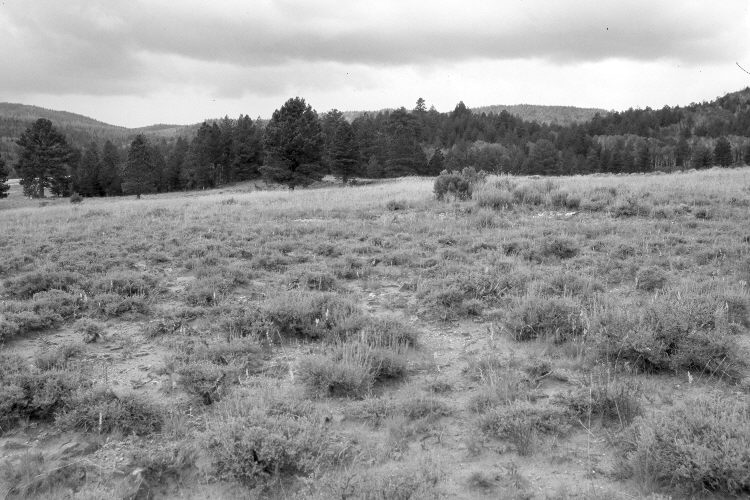
Plate 996X. Bunker Creek 1957 – 2005 Viewed west to the start of the Bunker Creek Parker Three-Step Transect southwest of Panguitch Lake. Ponderosa pine has increased in the distance, while aspen has declined. The low shrub in the foreground is three-tipped sage, while the taller shrubs near the transect starting point are currants. The area was actively being grazed by cattle in 2005.
Photo Information:
U.S. Forest Service photograph (unnumbered) taken on August 1, 1957; retake by Charles E. Kay on August 1, 2005 - - Photo No. 5499-22. Original photographs, negatives, and narrative reports held in the range files on the Cedar City Ranger District, Dixie National Forest, Cedar City, UT.
Vegetative Community:
Conifer, Aspen, Sagebrush
Location:
South West: Section 7, Range 7 West, Township 36 South; UTM of transect starting point 352300 E, 4173350 N; elevation 8,500 ft.