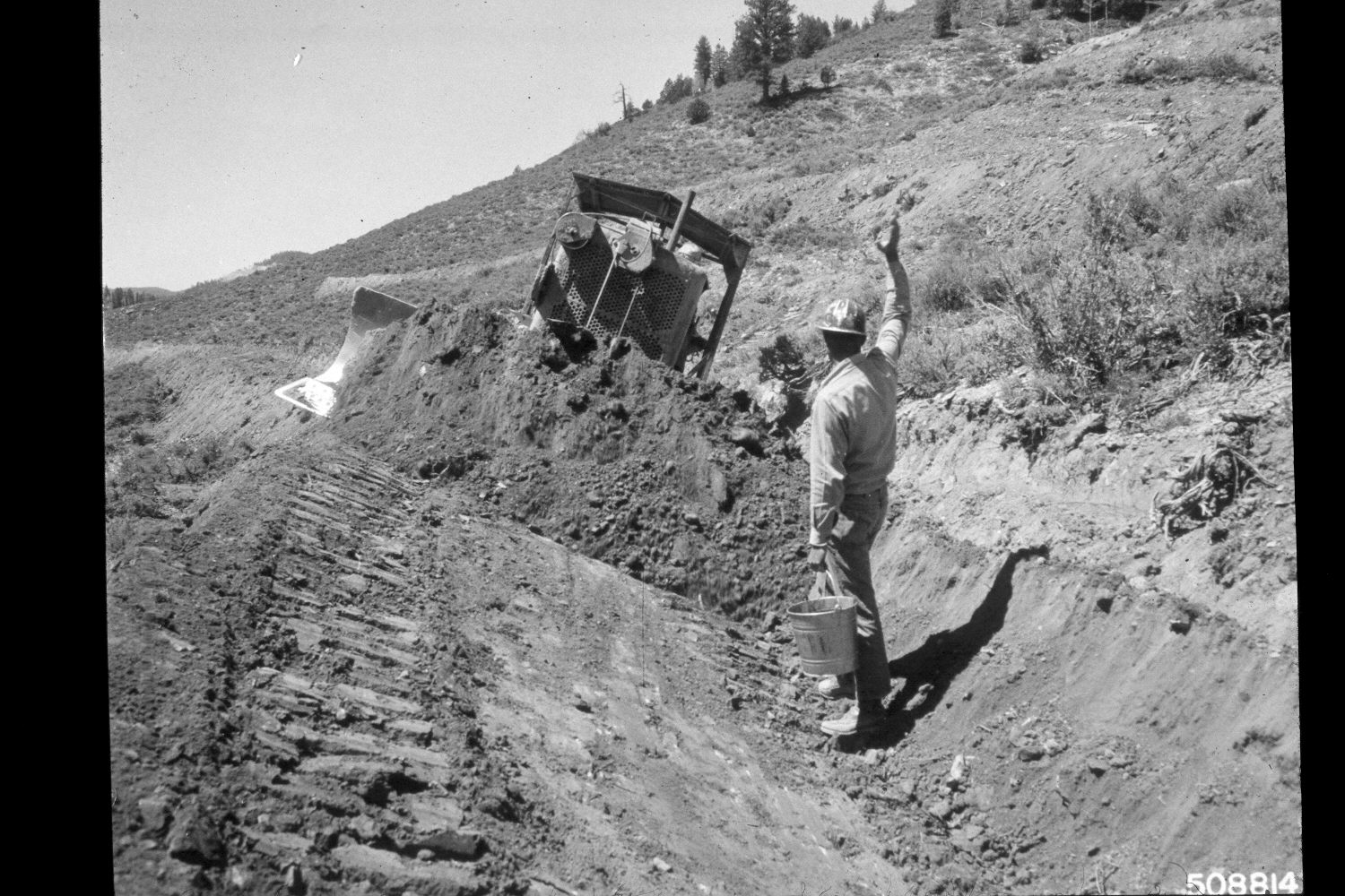
Buck Knoll
1964
2003
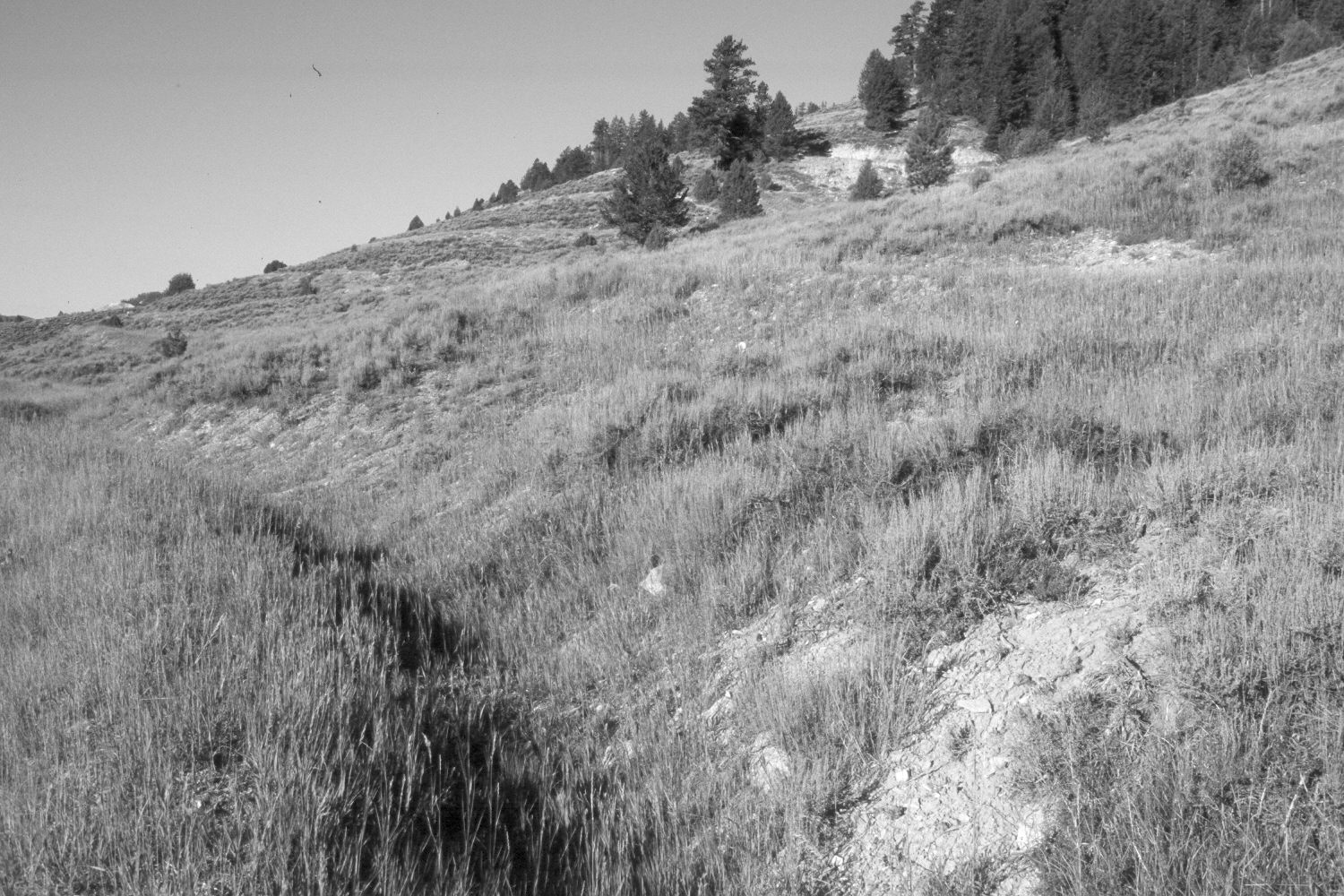
Description:
Plate 296X. Buck Knoll 1964 - 2003 Viewed south-southwest along the eastern edge of Buck Knoll on the Paunsaugunt Plateau. Shown in the original image is a D-7 cat constructing contour trenches. The entire area was reseeded by the Forest Service with smooth brome and intermediate wheatgrass to control erosion and improve range conditions. Juniper, ponderosa pine, and limber pine have all increased. The shrubs are mostly mountain big sage and bitterbrush.
Photo Information:
U.S. Forest Service photograph (508814) taken by Prater in August 1964; retake by Charles E. Kay on August 8, 2003 - - Photo No. 5229-32. Original photograph (2520-2-Land Treatment-Dixie) held by the Forest Service Regional Office Photographic Collection housed at Weber State University, Ogden, UT.
Vegetative Community:
Dry Meadow, Juniper, Conifer, Sagebrush, Riparian
Location:
South West: Section 36, Range 4½ West, Township 38 South; UTM 386800E, 4155700 N; elevation 8,000 ft.