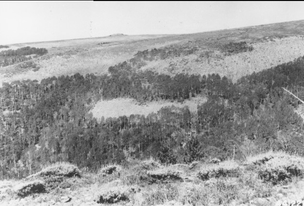
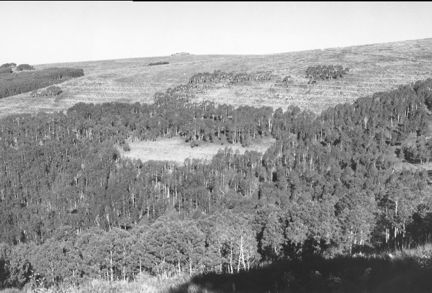
Broad Canyon
1946
1999
Description:
Plate 105. BROAD CANYON: 1946 - 1999 The view is over the head of Broad Canyon to Jacks Peak. This is just to the left of Plate 104 and shows the area prior to contour trenching and seeding. Conifers blocked the 1946 photo point and required shifting the 1999 retake approximately 100 feet north. The area was later contour trenched and seeded. Aspen (Populus tremuloides) is taller in 1999 than in the 1946 photo, but it has not regenerated.
Photo Information:
1946 photo is U.S. Forest Service #441221 taken Sept. 25; 1999 photo is Kay #4490-11A, taken on Sept. 5. Forest Service photo held by the Forest Service Regional Office Photographic Collection housed at Weber State Univ., Ogden, UT
Vegetative Community:
Aspen, Conifer, Sagebrush
Location:
South Central: North Fork of Chalk Creek, Fishlake National Forest, Fillmore Ranger District, T21S, R2.5W, Sect. 15, UTM 4315200 N, 402350 E; elevation 9,600 ft., viewed to northwest.