Brian Head
1937
2005
Description:
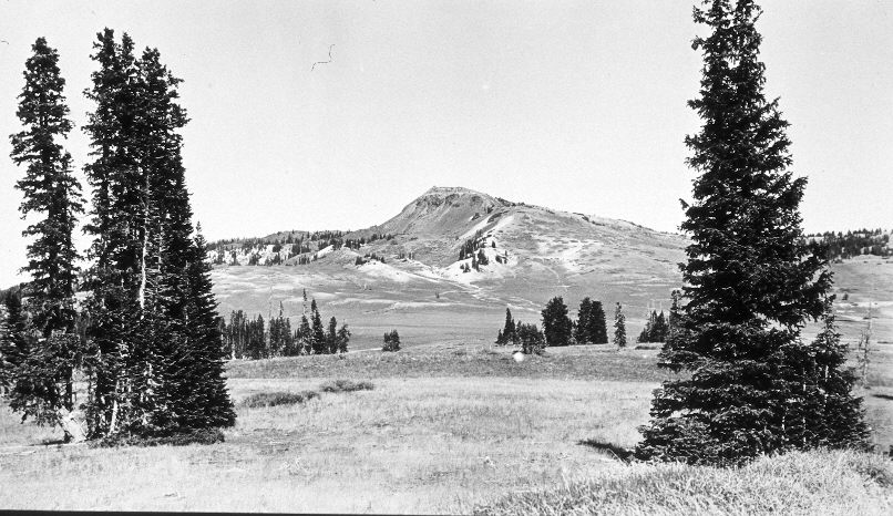
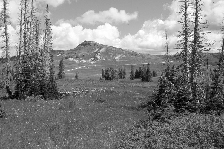
Plate 1125X. Brian Head 1937 – 2005 Viewed north-northeast to Brian Head (11,307 ft.). The area between the camera and the fence in the distance is part of Cedar Breaks National Monument and has not been grazed by livestock for many years, while the area beyond the fence is grazed yearly by domestic sheep. The shrubs in the foreground are currants. Spruce has increased but many of the older trees were recently killed by insects and disease. Tall forbs and total plant cover have increased. Utah Highway 143 is visible in the retake, as is the road to Brian Head. The lower slopes of Brian Head are more vegetated today than in the past and soil erosion has decreased - - see Plates 1120x to 1124X.
Photo Information:
Original photograph taken by J.C. Anderson (No. 38) in 1937; retake by Charles E. Kay on September 4, 2005 - - Photo No. 5556-8A. Original photograph held by the U.S. Geological Survey Photographic Library, Denver, CO.
Vegetative Community:
Dry Meadow, Conifer
Location:
South West: Section 23, Range 9 West, Township 36 South; UTM 337650 E, 4169500 N; elevation 10,540 ft.