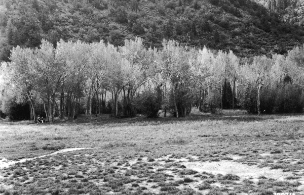
Bowery Creek
1939
2006
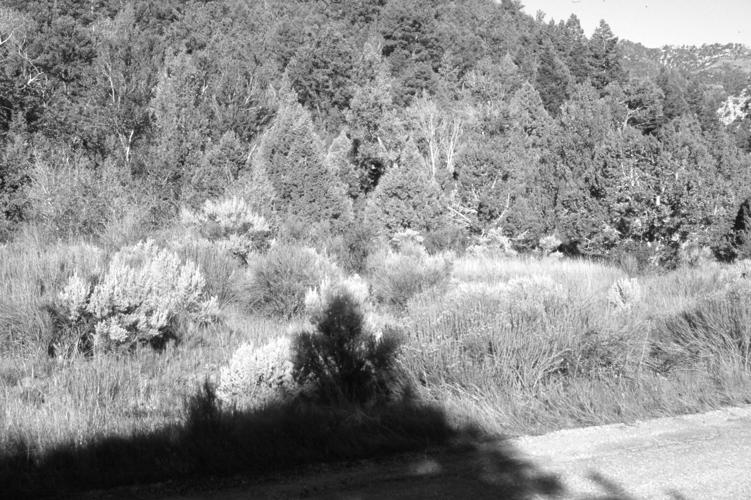
Description:
Plate 1391X. Bowery Creek 1939 – 2006 Viewed west down Bowery Creek in First Left Hand Canyon south of Parowan, Utah. Shown in the 1939 image is the old Vermillion Castle Campground baseball diamond on which crested wheatgrass had been planted. The road up First Left Hand Canyon was originally on the far side of the creek at the base of the distant hill, but has now been moved north of the stream and paved - - photo lower right. Pinyon, juniper, and conifers have increased most dramatically, especially on the old ball field as have rubber rabbitbrush and sagebrush. As pinyon and juniper have invaded the floodplain, cottonwoods have declined or become hidden from view. Needless to say, forest fuels have increased setting the stage for a high-intensity crown fire.
Photo Information:
U.S. Forest Service photograph (390715) taken by Lincoln Ellison on October 4, 1939; retake by Charles E. Kay on August 6, 2006 - - Photo No. 5715-24. Original photograph held by the Utah Historical Society, Reed W. Bailey Collection (Box 1), Salt Lake City, UT.
Vegetative Community:
Dry Meadow, Pinyon, Juniper, Conifer
Location:
South West: Section 6, Range 8 West, Township 35 South; UTM 341900 E, 4184400 N; elevation 6,900 ft.