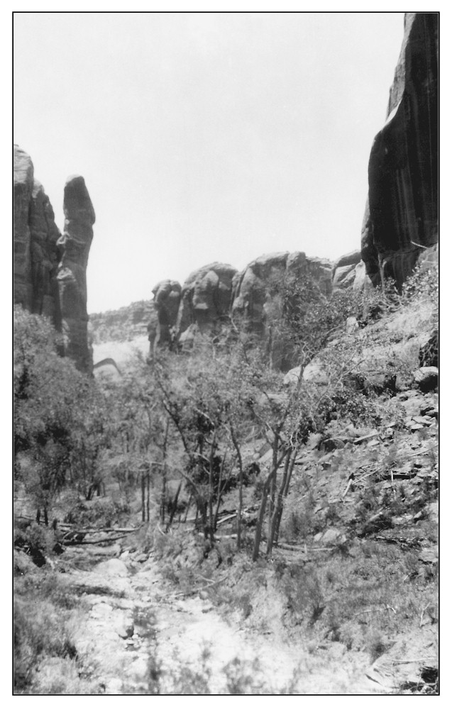
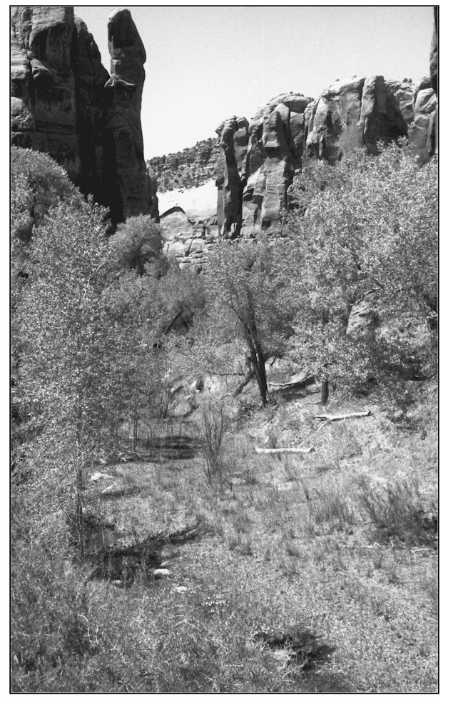
Bobby's Hole
1927
1999
Description:
BOBBY'S HOLE This site is in Bobby's Hole Canyon less than 1/4 mile upstream from where it joins Hart Draw. The downstream view actually shows blind windows on the west wall of Hart Canyon. The area is public land administered by the Bureau of Land Management. Improvement at this site is obvious. The wide rocky channel, visible in the 1927 photograph, has slightly aggraded, and has formed an active floodplain. The banks have evolved back to lesser angles and the whole channel has stabilized with a good variety of riparian vegetation including Fremont cottonwood, narrowleaf cottonwood, boxelder, coyote willow, yellow willow, bulrush, Baltic rush, cattail, and horsetail. There are also a few tamarisk plants at this site.
Photo Information:
Photograph Number: Goldman No. 398 Original: Date: May 29, 1927 (- A) Photographer: M.I. Goldman Source: U.S. Geological Survey, Denver, Colorado Retake: Date: May 12, 1999 (- B) Photographer: Earl Hindley Source: San Juan County
Vegetative Community:
Riparian
Location:
San Juan: SE1/4NW1/4 Section 27 T.30S., R.22E.