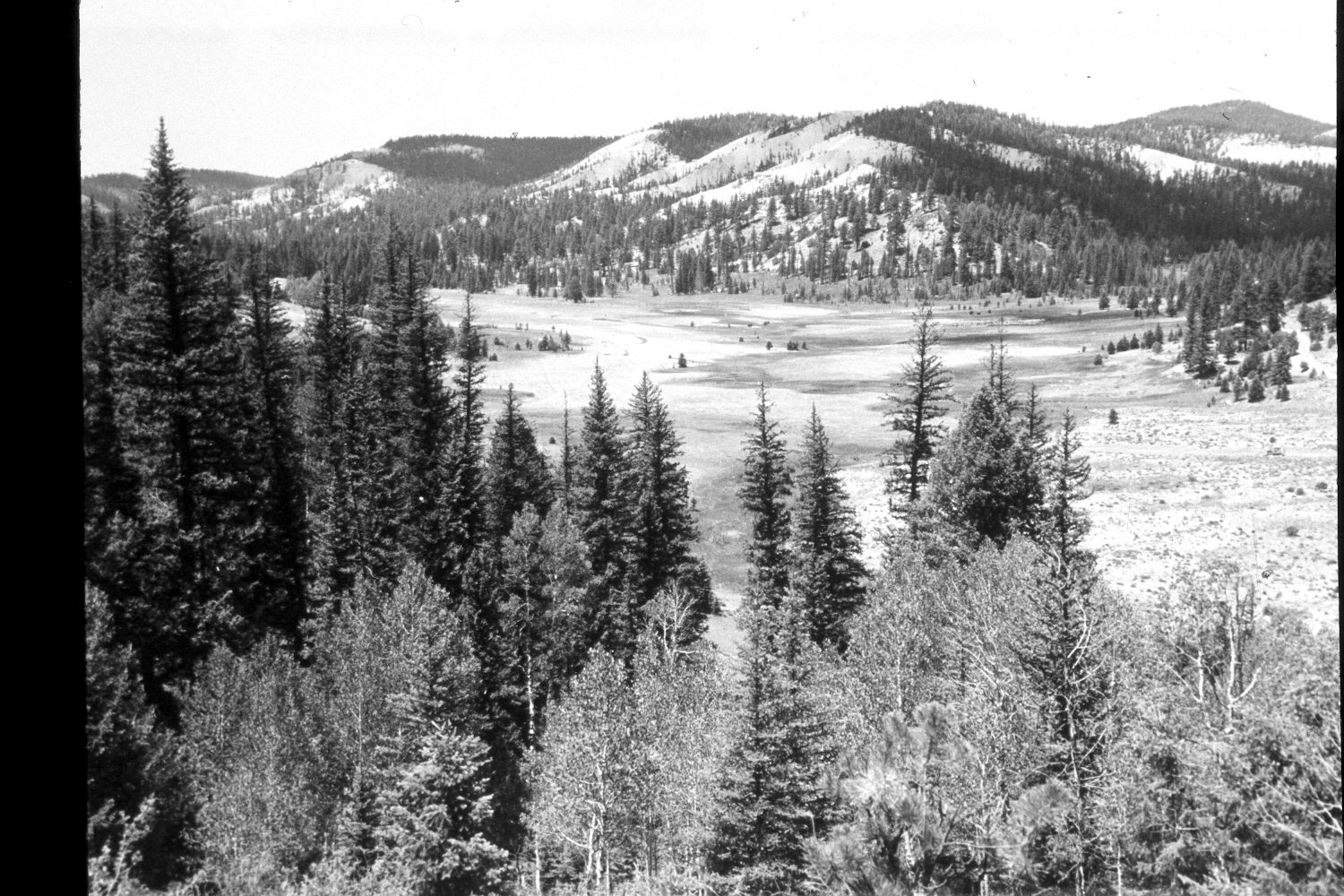
Blubber Creek
1960
2003
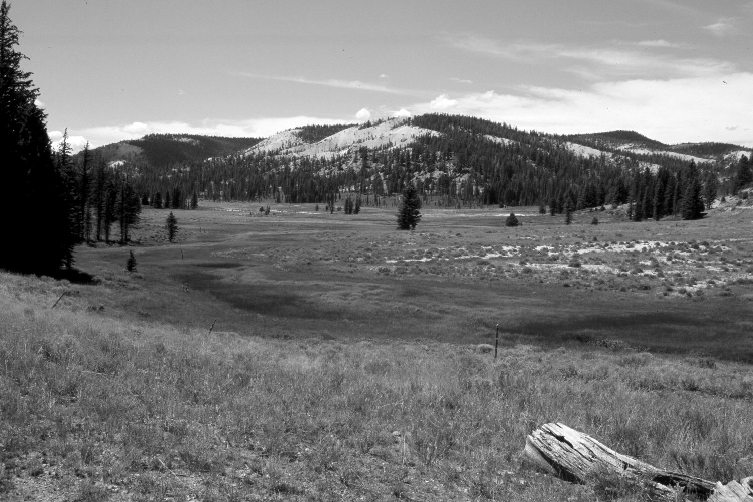
Description:
Plate 278X. Blubber Creek ca. 1960 - 2003 Viewed west-northwest to the confluence of the Left and Right Forks of Blubber Creek on the Paunsaugunt Plateau. The original camera station is located on an old logging road on the north side of Buck Knoll. Conifers, however, now block that view, so the retake was made from the nearest open area, which is at a considerably lower elevation - - thus the difference in perspective between the two photos. Despite repeated logging, spruce and ponderosa pine have increased, but aspen has declined. The low shrubs in the retake are mostly shrubby cinquefoil and rubber rabbitbrush.
Photo Information:
U.S. Forest Service photograph (unnumbered) taken ca. 1960; retake by Charles E. Kay on August 6, 2003 - - Photo No. 5223-17. Original photograph held by Southern Utah University Archives and Special Collections, Cedar City, UT.
Vegetative Community:
Conifer, Aspen, Dry Meadow, Riparian
Location:
South West: Section 36, Range 4½ West, Township 37 South; UTM 385900E, 4156250 N; elevation 8,020 ft.