Blowhard Flat
1960
2006
Description:
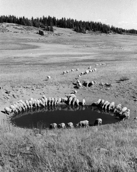
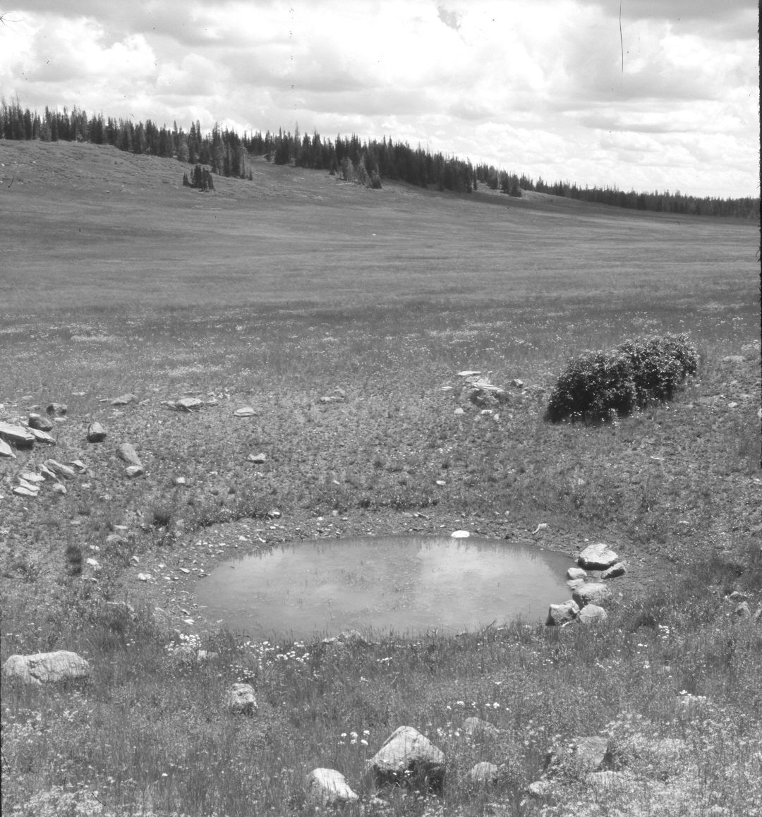
Plate 1365X. Blowhard Flat 1960 – 2006 Viewed southeast across Blowhard Flat to Blowhard Exclosure - - see Plates 1090x to 1095x. The tall shrubs on the right are elderberry, while the more distant, lower-growing shrubs are currants, which appear to have increased. Conifers too have increased, though, many spruce were recently killed by insects and disease. This photopoint is just beyond the southern boundary of Cedar Breaks National Monument along Utah Highway 148. Blowhard Flat is grazed annually by domestic sheep.
Photo Information:
U.S. Forest Service photograph (unnumbered) taken ca. 1960; retake by Charles E. Kay on August 3, 2006 - - Photo No. 5705-10. Original photograph held by Southern Utah University Archives and Special Collections, Cedar City, UT.
Vegetative Community:
Conifer, Dry Meadow
Location:
South West: Section 14, Range 9 West, Township 37 South; UTM 336750 E, 4163250 N; elevation 10,300 ft.