Blowhard Flat
1952
2005

Description:
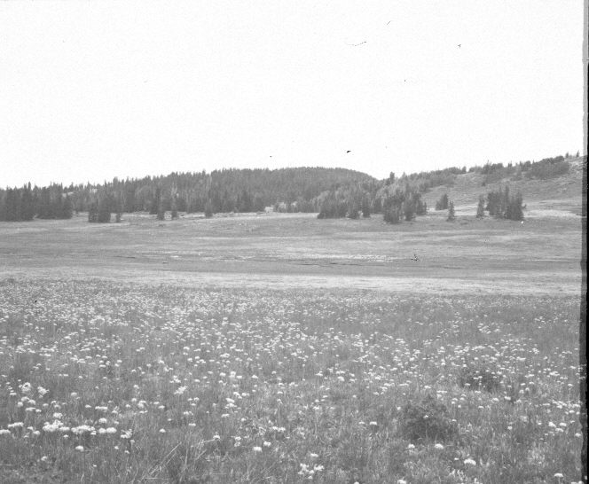
Plate 1091X. Blowhard Flat 1952 – 2005 Viewed west-southwest across Blowhard Flat to Blowhard Mountain (10,657 ft.) - - note the FAA radar dome in the retake. Utah Highway 148 is visible in the 2005 image. The white flowers in the foreground are yarrow, while bistort is common in the wetter valley. Stipa spp. is abundant. Conifers have increased, but many of the older spruce were recently killed by insects and disease. Aspen has declined and been heavily invaded by spruce. All aspen suckers are heavily browsed. The area is grazed yearly by domestic sheep, but had not yet been grazed when the 2005 retake was made.
Photo Information:
U.S. Forest Service photograph (unnumbered) taken on July 18, 1952; retake by Charles E. Kay on September 1, 2005 - - Photo No. 5539-9. Original photographs, negatives, and narrative reports held in the range files on the Cedar City Ranger District, Dixie National Forest, Cedar City, UT.
Vegetative Community:
Dry Meadow, Conifer, Aspen
Location:
South West: Section 14, Range 9 West, Township 37 South; UTM of the exclosure 337100 E, 4162900 N; elevation 10,280 ft.